This article is part of a two-part series by ACLC student Alex MacIsaac on the kinds of skills and opportunities ACLC emphasizes through its courses, extracurricular activities, work experiences, work-integrated practicums, and experiential projects. The series showcases work experiences available to Faculty of Arts, including ACLC, students. This two-part series focuses on digital mapping opportunities in the context of ACLC faculty research projects.
Dr. Kate Scarth is an Assistant Professor in Applied Communication, Leadership, and Culture (ACLC) at the University of Prince Edward Island. Dr. Scarth is also the Chair of L.M. Montgomery Studies where she works closely with the L.M. Montgomery Institute (LMMI). The LMMI is dedicated to researching the life and works of one of Canada’s most cherished authors. Here, Dr. Scarth leads a team of students in creating research projects related to L.M. Montgomery.
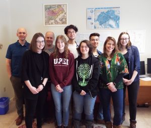
These Montgomery projects enhance skills and experiences at the core of the ACLC program. Dr. Scarth’s student assistants work on digital humanities projects, learning to communicate and engage people with history and literature through digital media. These students gain confidence in working with technology and create real products of interest both locally and internationally. Heidi Haering and Michaela Wipond are two students working on mapping Montgomery digitally.
Heidi Haering is a third-year student at UPEI, majoring in Anthropology and minoring in Philosophy and Biology. Heidi is working on a range of mapping projects as part of a proposed L.M. Montgomery Institute Hub, which focuses on engaging the public around Montgomery and supporting Montgomery stakeholders. Heidi works with the mapping program, ArcGIS, to create two different LMMI projects, an international engagement project and a walking tour of Halifax.
ArcGIS is a Geographic Information System (GIS for short) program. It is a system designed to capture, store, manipulate, analyze, manage, and present spatial or geographic data. Heidi uses ArcGIS to visualize, plot, and reference noteworthy Montgomery locations.
For the international engagement project, the LMMI will be collecting information from L.M. Montgomery fans from all over the world. This information includes where fans are from and why they enjoy L.M. Montgomery. After Heidi acquires the information, she will use ArcGIS to plot the data onto a digital map. Map users will be able to view and interact with points of interest displaying where Montgomery fans are located internationally. Heidi explains, “We’re mainly trying to use (digital maps) as an engagement platform.” The goal of the project is to help foster a global community of Montgomery fans and to showcase the possibilities of crowd-sourced maps.
Heidi is also assisting on a Halifax walking tour project. The project (also being digitally mapped with ArcGIS) will take people on a tour of all sites related to Montgomery and her time in Halifax. It will also include Anne of Green Gables’ time in the fictional town of “Kingsport”—based on Halifax—in Montgomery’s novel, Anne of the Island. The tour will allow fans to walk in Montgomery’s and Anne’s footsteps, and give fans a sense of what the author and character experienced while living in Halifax/Kingsport. This project is a model for similar projects the LMMI will undertake on Montgomery’s PEI locations.
These projects aim to engage Montgomery’s readers and fans. Of course, a passion for Montgomery’s writing is also a great asset in working on Montgomery projects at UPEI. Michaela Wipond is a fourth-year student at UPEI, majoring in English and minoring in History and Theatre studies. When she was younger, Michaela received Anne of Green Gables for her birthday, which began her love for L.M. Montgomery’s works. Michaela moved to Charlottetown specifically so she could study Montgomery.

Pictured: Student Michaela Wipond
One of Michaela’s main tasks is to perform research for Dr. Scarth’s Halifax Literary Landmarks project. This digital literary tour includes descriptions of Halifax in L.M. Montgomery’s books as well as other literature about the city from before 1918. At the core of this tour is a map, created with the digital exhibition program, Omeka, which will lead users through these literary points of interest. Michaela explains, “We wanted (the project) to be accessible to people who were either in Halifax or not in Halifax. Right now, what I’m primarily working on is the website so that someone anywhere can go on the website and say, ‘I want to learn about representations of Point Pleasant Park,’ and they could click on a link and read the different descriptions and sights and quotes (about the location).”
There will be a guided tour, in audio and text forms, that will accompany the map to explain the significance of the locations. These multiple types of experience allow for anyone, whether in Halifax or anywhere else in the world, to experience the tour in a form that is accessible to them.
The Halifax Literary Landmarks research team has compiled an extensive list of texts about Halifax literature. Michaela goes through those texts in order to find the most accurate, relevant, and interesting sources for the project. She also writes for the Halifax Literary Landmarks project, and has contributed to the LMMI’s website and social media.
These projects from the LMMI use digital media in order to communicate information in innovative ways. Going forward, the LMMI hopes to continue engaging individuals locally and internationally through digital media.
These are just a few examples of the ways Arts students can develop skills and have interesting work experiences on campus. Be sure to watch UPEI’s Human Resources’ ads for Student Positions! Link: http://www.upei.ca/hr/student-positions
Find out more about UPEI’s Applied Communication, Leadership, and Culture program
Find out more about the L.M. Montgomery Institute
The Halifax Literary Landmarks project:
The website is coming soon.
This research was supported by the Social Sciences and Humanities Research Council of Canada.

It is also supported by the Nova Scotia Museum.
Supported by the Office of the President at UPEI through funding for the Chair of Montgomery Studies in support of the proposed L. M. Montgomery Institute Public Engagement and Research Hub.





 “In this job, there’s been a lot of freedom for different students to utilize their different backgrounds and skills in ways that are useful to the projects.”