

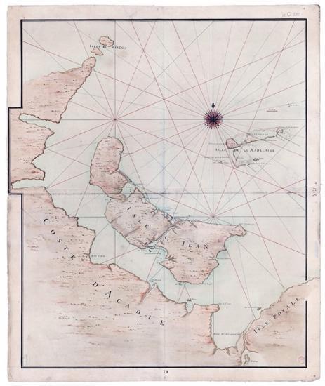
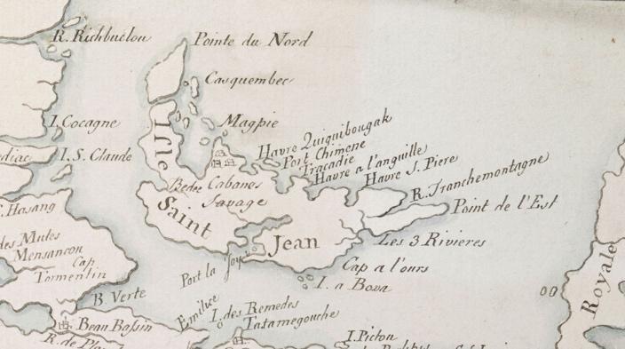
Anonymous maps, likely between 1720 and 1730 since the first Acadian communities were only established in 1720.
Bibliography entry (L):
Anonymous. Isle St-Jean, isles de Miscou, isles de la Madelaine, coste d’Acadie, isle Royale. Map. 1713. Bibliotheque Nationale, Paris, btv1b530644681.
Bibliography entry (R):
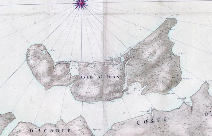
Anonymous. Plan des 1720-30 Plan des côtes N. de l’Acadie avec les îles de St Jean. Map. C1730. Bibliotheque Nationale, Paris, btv1b53089893w.
Image acknowledgement:
Courtesy Reg Porter, from https://regporter.com/pei/2020/11/25/maps-of-the-colony-of-ile-saint-jean-part-1-1720-1745/
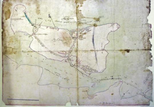
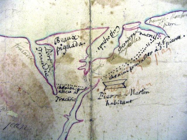
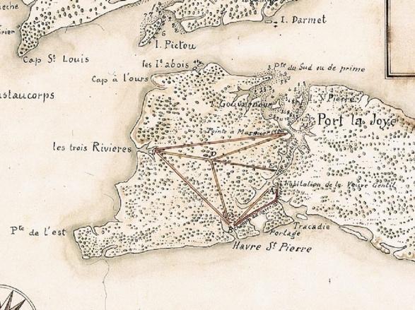
Anonymous map known as “The d’Arrigrand Map” due to bottom label. Undated but labels similar to (A) and (B). Provides additional detail for Tracadie-St. Peters area.
Bibliography entry:
Anonymous. The d’Arrigrand Map. Map. 1713. PEI Archives and Records Office, map 0,547.
Image acknowledgement:
Courtesy Reg Porter, from https://regporter.com/pei/2020/11/25/maps-of-the-colony-of-ile-saint-jean-part-1-1720-1745/
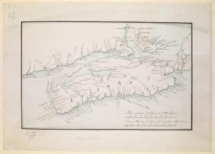
Map erroneously dated 1690; likely between 1740 and 1750, given additional/changed labels to earlier maps. After Jacques Bellin, 1744.
Bibliography entry:
Anonymous. Acadie, Isle Saint Jean and part of Isle Royale with the Baye Francoise. Map. 1713. Paris: Bibliotheque national, 20014430.
Image acknowledgement:
Map reproduction courtesy of the Norman B. Leventhal Map & Education Center at the Boston Public Library, https://collections.leventhalmap.org/search/commonwealth:hx11z489p
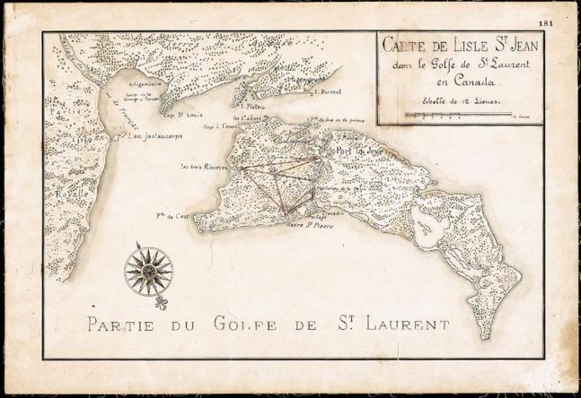
Map from the survey of Louis Franquet, 1751. More detail can be found in Gone to the Bay, Three Centuries and the Island, Reg Porter’s blog, and Island Magazine articles.
Bibliography entry:
Franquet, Sr. Louis. Carte de l’Isle St Jean dans la Golfe de St. Laurent en Canada. Map. 1751. Library and Archives Canada, Collection Louis Franquet, H-3023, https://heritage.canadiana.ca/view/oocihm.lac_reel_h3023/62.
Image acknowledgement:
Courtesy Reg Porter, https://regporter.com/pei/2020/11/25/maps-of-the-colony-of-ile-saint-jean-part-1-1720-1745/
W.J. Herbert’s map of the island, post-Deportation but prior to the Holland Survey. Details French settlements. Dated 1760 by Island Imagined by 1764 by PARO.
Cleared land may be exaggerated, but note elements of this map that do not appear on Holland’s survey (e.g. the church at St. Pierre).
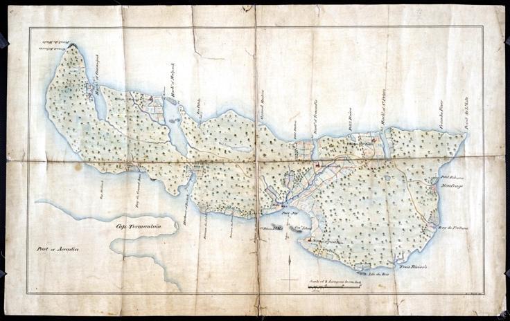
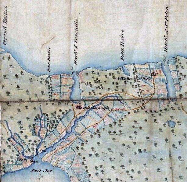
Bibliography entry:
Hebert, W.J. [No title]. Map. 1764. PEI Archives and Records Office, 0,450.
Image acknowledgement:
Map source: UPEI Island Imagined, https://islandimagined.ca/islandora/object/imagined%3Aparo-0450