

Georeferenced aerial photo surveys are available through the GeoREACH lab’s ArcGIS platform or through GeoPEI for the following years.
1935
1968
2000 2020
Aerial photo surveys are also available through the Government of Prince Edward Island at https://www.princeedwardisland.ca/en/feature/aerial-photo-index-map#/service/AerialPhotoIndexMap/AerialPhotoIndexMap for the following years. Note that the flightpaths were different in these cases and may be difficult to overlay.
1958
1974
1990
And through their “Orthophoto Map Comparison”, for 2000, 2010, 2020.
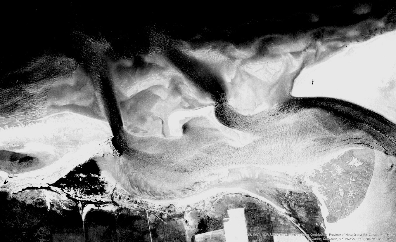
Example:
Bibliography entry:
Canada, National Air Photo Library. [St. Peters Harbour, PEI.] Air Photo. Flightline 5331. Photo 57. [if known] Ottawa, Ontario: Natural Resources Canada, 1935. https://experience.arcgis.com/experience/9870ec990eaa40069f772b7025fbd18c/. Accessed May 7, 2024.
Image acknowledgement:
Map source: GeoPEI: PEI Historical Maps, Geospatial Research in Atlantic Canadian History, The GeoREACH Lab, UPEI,
https://experience.arcgis.com/experience/9870ec990eaa40069f772b7025fbd18c/
Photos courtesy Natural Resources Canada / Government of Prince Edward Island [depending on year].
A series of short videos taken by Shawn Naylor in October 1985 provides views of the PEI Railway, not long before it closed to freight in 1989 (having closed to passenger traffic in 1969). Today these views form part of the Confederation Trail.
The Prince Edward Island Railway Channel on YouTube (https://www.youtube.com/channel/UCG6I9ydewLaE9Apfavo-TCg) includes the following videos:
- Prince Edward Island railway 1 – CN train leaves Emerald Junction, PEI, and proceeds westward
- Prince Edward Island railway 2 – Train at Clyde, Colville and Royalty Junction, PEI (filmed Oct 22, 1985, by Shawn Naylor)
- Prince Edward Island railway 3 – switching cars at York, PEI
- Prince Edward Island railway 4 – cab ride along Hillsborough River, PEI (filmed Oct 22, 1985, by Shawn Naylor)
- Prince Edward Island railway 5 – Cab ride through Mount Stewart, PEI (filmed Oct 22, 1985, by Shawn Naylor)
- Prince Edward Island Railway 6 – Cab ride 1754 along Pisquid River, PEI
Example Bibliography entry:
Naylor, Shawn. “Prince Edward Island railway 5 – Cab ride through Mount Stewart, PEI.” Prince Edward Island Railway, 1985. Video, 3:34. https://www.youtube.com/watch?v=-qv2z7FrhlM&ab_channel=PrinceEdwardIslandRailway.
The Geological Survey of Canada produced a series of videos in the late 1980s and early 1990s that have been saved on the YouTube channel Canada Aerial Video (https://www.youtube.com/@canadaaerialvideo3686/videos).
For Prince Edward Island, ten hour-long videos were shot along the coast between 1988 and 1990; the associated report is found in GEOSCAN at https://ostrnrcan-dostrncan.canada.ca/entities/publication/6e6be078-830e-4c8c-b587-9342aa1f12bd.
- Aerial Survey, Part 1 East Point to Point Deroche, Prince Edward Island Coastline (1990)
- Aerial Survey, Part 2 Point Deroche to Entrance of New London Bay, Prince Edward Island Coastline (1990)
- Aerial Survey, Part 3 Entrance of New London Bay to Bideford River area, Malpeque Bay, Prince Edward Island Coastline (1990)
- Aerial Survey, Part 4 Bideford River area, Malpeque Bay to Tignish Run, Prince Edward Island Coastline (1990)
- Aerial Survey, Part 5 Tignish Run to Entrance to Percival Bay, Prince Edward Island Coastline (1990)
- Aerial Survey, Part 6 Entrance to Percival to Seacow Head, Prince Edward Island Coastline (1990)
- Aerial Survey, Part 7 Seacow Head to Orwell Bay, Prince Edward Island Coastline (1988)
- Aerial Survey, Part 8 Orwell Bay to Graham Pond, Prince Edward Island Coastline (1990)
- Aerial Survey, Part 9 Graham Pond to Boughton River, Prince Edward Island Coastline (1990)
- Aerial Survey, Part 10 Boughton River to East Point, Prince Edward Island Coastline (1990)
Example:
Bibliography entry:
Taylor, R. B. and D.H. Frobel. “Aerial Survey, Part 1 East Point to Point Deroche, Prince Edward Island Coastline.” Geological Survey of Canada, Open File 2580. 1992. Video, 58:56. https://www.youtube.com/watch?v=7FC6NT5GpqY&ab_channel=CanadaAerialVideo