

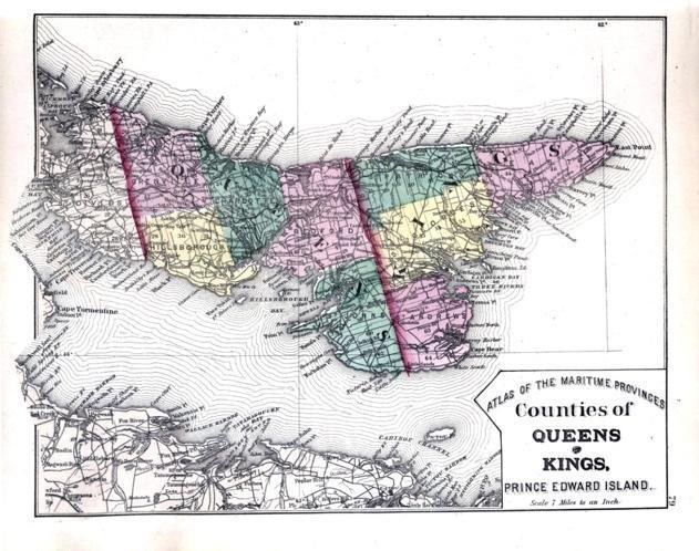
Roe’s Atlas, 1879. Two maps for Prince Edward Island, also maps for NB, NS, part of Nfld. Atlas also includes geological maps.
These maps can be found in Island Imagined (https://islandimagined.ca/roe_atlas), but there are better quality maps available from Reg Porter’s blog (https://regporter.com/pei/2021/07/22/the-maps-between-lake-and-meacham-confederation-and-the-railway-1864-1880/)
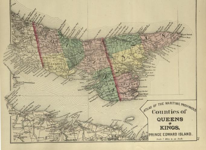
Bibliography entry:
Roe Brothers. Counties of Queens & Kings, Prince Edward Island. St. John, NB, 1878. Atlas Map, 79. Island Imagined, Robertson Library, UPEI, https://islandimagined.ca/islandora/object/imagined:208737. (Access date).
Image acknowledgement (second map):
Courtesy Reg Porter, https://regporter.com/pei/2021/07/22/the-maps-between-lake-and-meacham-confederation-and-the-railway-1864-1880/
Meacham’s Atlas, 1880. This atlas contains maps of all lots, along with illustrations of significant buildings and citizens, maps of towns and villages, and lists of businesses.
However, since the focus is on property ownership, there is little detail along the coasts, so it is not clear if the prevalence of “sandy beach”, for instance, reflects absence of dunes due to storms (1851, 1973) or lack of interest.
Meacham’s maps can be found on UPEI’s Island Imagined website, but have also been georeferenced in GeoPEI: PEI Historical Maps, Geospatial Research in Atlantic Canadian History, The GeoREACH Lab, UPEI.
https://experience.arcgis.com/experience/9870ec990eaa40069f772b7025fbd18c/
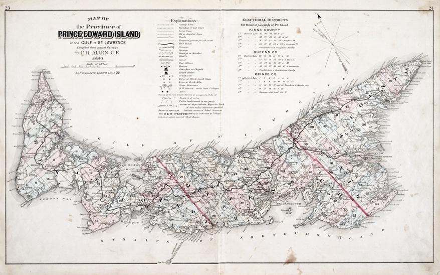
Bibliography entry:
Allen, C.R. Map of the Province of Prince Edward Island in the Gulf of St. Lawrence. Philadelphia, PA: J.H. Meacham & Co., 1880. Atlas Map, 23-24. Island Imagined, Robertson Library, UPEI.
Image acknowledgement:
Map source: UPEI Island Imagined, https://islandimagined.ca/islandora/object/imagined:208366
Cundall, 1903. Revision of 1852 Wright (and 1861 Cundall)
No digitized copies are available of this map, but the GeoREACH Lab has an original hard copy. Edits include the steamship line between Summerside and Charlottetown, plus placenames, roads, etc.
Although Wright and Bayfield are credited, it is unclear if any further coastal surveying was done, since the shoreline would have had significant reconfiguration in the intervening decades. For example, Bowley Pond still opens to the SW, with no corrections by either Cundall or Bayfield (who lived in PEI until 1895).
See also Reg Porter, https://regporter.com/pei/2021/10/25/island-maps-the-years-after-meacham-to-world-war-ii-part-1/
Cummins Atlas, 1928, including local directories. Can be found in several collections, and accessed through GeoPEI.
https://www.davidrumsey.com/luna/servlet/view/all/who/Cummins+Map+Co./
https://islandimagined.ca/cummins_atlas
GeoPEI: https://experience.arcgis.com/experience/9870ec990eaa40069f772b7025fbd18c/
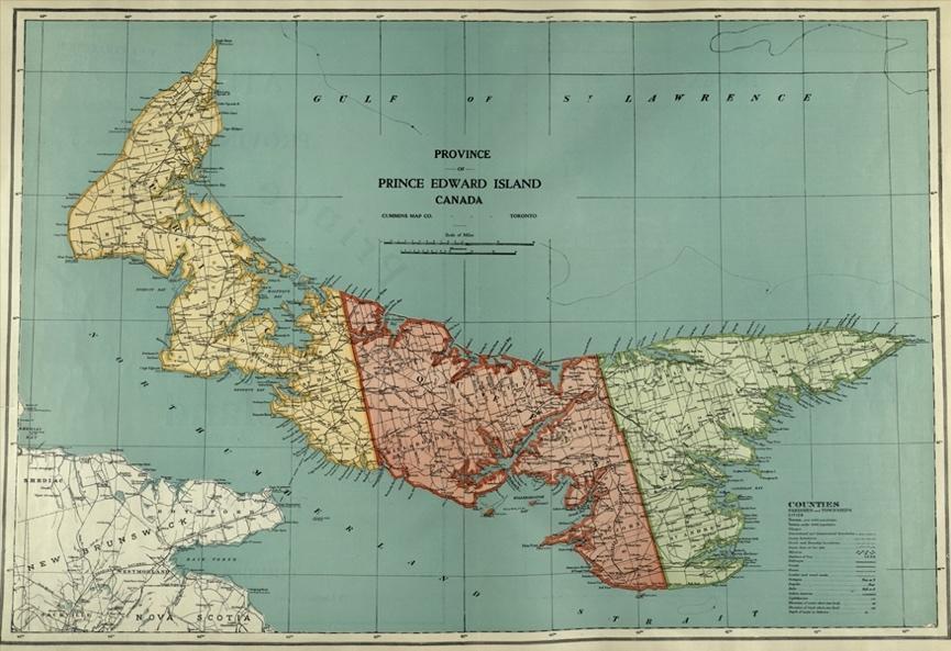
Bibliography entry:
Arniel, Melville S. Province of Prince Edward Island, Canada. Toronto, ON: Cummins Map Company, 1928. Atlas Map, ii. Island Imagined, Robertson Library, UPEI.
Image acknowledgement:
Map source: UPEI Island Imagined, https://islandimagined.ca/islandora/object/imagined:208753
Geological Survey of Canada (GSC) Topographic Maps, Series 3400s_63_1929
This series of topographic maps, generated between 1925 and 1945, is at a scale of 1:63,360 (1” = 1 mile) and split into sheets and grids across Canada, with the majority of Prince Edward Island found on sheet 11. These maps have been downloaded by the GeoREACH lab and can be georeferenced in ArcGIS.
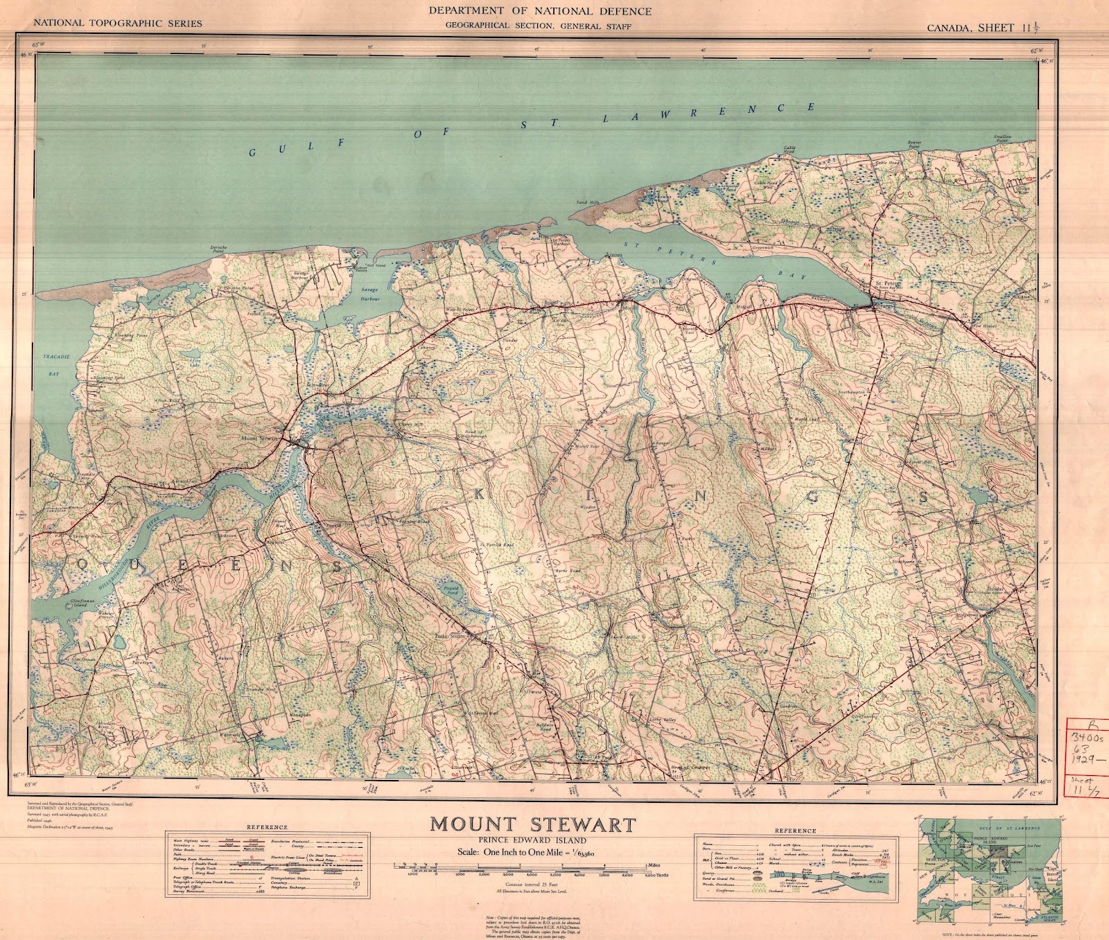
Bibliography entry for example:
Canada, Department of National Defence. Mount Stewart, Prince Edward Island. Map. Ottawa: Department of Mines and Resources, 1945. National Topographic Series 3400s_63, 1929, 11/7.
Image acknowledgement:
Courtesy of the GeoREACH lab, University of Prince Edward Island.
National Topographic Survey (NTS), Series 3400s_50_1948
This series of topographic maps, generated since 1945, is at a scale of 1:50,000 (1cm = 0.5km) and split into sheets and grids across Canada, with the majority of Prince Edward Island again found on sheet 11.
These maps have been release in a series of editions or phases, in print-ready and georeferenced formats:
- Edition 1, simply a conversion from imperial to metric (1:63,360 > 1:50,000), based on earlier surveys, i.e. no difference in map features. Some grids were split into E and W portions for convenience.
- Edition 2, updated and printed in the 1960s
- Edition 3, updated (and recombined) in the 1970s
These three editions have been downloaded to the GeoREACH lab’s servers, and georeferenced versions of Edition 2 have been included on the GeoPEI application. Note that you need to zoom in for this layer to become visible. For screenshots, you can turn off the current street labels by selecting an alternate base map.
Example:
Bibliography entry:
Canada, Department of Energy Mines and Resources. [St. Peters Harbour.] Ottawa: Department of Mines and Resources, 1965. National Topographic Series 3400s_50, 1948, 11/7W and 7E [if known].
Image acknowledgement:
Map source: GeoPEI: PEI Historical Maps, Geospatial Research in Atlantic Canadian History, The GeoREACH Lab, UPEI,
https://experience.arcgis.com/experience/9870ec990eaa40069f772b7025fbd18c/. Digital maps courtesy Natural Resources Canada.
More recent editions can also be found at the FTP site: http://ftp.maps.canada.ca/pub/nrcan_rncan/raster/topographic/ in TIF, PDF, GEOTIFF and GEOPDF formats. You only have to look at one index per scale to see the list of available topographic map editions. The CanTopo product is always the most recent map edition, but is not available everywhere.
Example of file nomenclature 011E03: http://ftp.maps.canada.ca/pub/nrcan_rncan/raster/topographic/50k/011/e/03/
Example of the directory content for file 011E03:
011e03_0501_cantopo_tif.zip – CanTopo product in format TIF – 5th Edition, version 1 011e03_0501_cantopo_pdf.zip- CanTopo product in format PDF – 5th Edition, version 1 011e03_0501_cantopo_geotiff.zip – CanTopo product in format GEOTIF – 5th Edition, version 1 011e03_0501_cantopo_geopdf.zip – CanTopo product in format GEOPDF – 5th Edition, version 1 011e03_0400_canmatrix_prttif.zip – CanMatrix product – Print ready in format TIFF – 4th Edition, version 0
011e03_0400_canmatrix_prtpdf.zip – CanMatrix product – Print ready in format PDF – 4th Edition, version 0
011e03_0400_canmatrix_geotiff.zip – CanMatrix product – Georeferenced in format TIFF – 4th Edition, version 0
In this example, the most recent map is edition 05, version 01 for the CanTopo product.
The catalogue, specifications and legend of each product are in the following documentation directory: http://ftp.maps.canada.ca/pub/nrcan_rncan/raster/topographic/doc/