Energy on the Philip Maher Farm and Windsor, Richmond, Quebec

Figure 1a. George J. Maher (b. 1861/d. unknown) and (we assume) his wife Olivia Gertrude Maher (nee Roy). George was the son of Philip Maher whose 1871 Canada Census profile we use for the Maher farm energy profile. The obituary of George’s son, George Jr., gives the name of his mother, Olivia Maher. See note 9 below. Photograph from Ancestry Family Trees, Ancestry.ca.

The Maher farm in Ontario’s Windsor County is an example of a Timber Extraction Enterprise with Supporting Livestock and Hay. In the 1871 Census of Canada, Philip Maher (b. 1832/ d. 1907) was reported as a tenant on a 40 acre (16.2 ha) farm. However, schedule 3 of the same census indicates that Philip owned 400 acres (161.8 ha) outside the division within Windsor in which the farm he occupied as a tenant was situated. These 161.8 ha were likely located nearby to where he and his family lived, and he was probably using them for timber extraction. The enumerator put him down as a lumberman, not a farmer nor cultivator. When combined, Philip’s two parcels of land totaled 178 ha. The 16.2 ha that Philip occupied was small compared to the average-sized farm (41.8 ha) of the Windsor census subdivision (CSD) in which it was located. However, when combined with his larger 161.2 ha parcel, the resulting 178 ha unit was 4.25 times the size of the average farm in the Windsor CSD. Philip’s parents, James Maher and Mary Ann Maher (nee Quigley) were both born in Ireland.[1] Philip, however, was born in Quebec, as were his two wives, both Quebecois, and all his children.[2] Sometime before 1853, Philip married Marie Ann Lemaitre dit Duhaime and they had six children, George (b. 1861/ d.unknown) being the eldest son. Philip’s second wife was Mary Julie Millette, and the couple had five children.[3] Philip emigrated to Penobscot, Maine, USA, in 1886, and naturalized in 1892.[4] He was accompanied by Julie, but it is unclear how many of his children made the move with them. His eldest son George was 25 years old at the time, and he had been reported as a clerk five years earlier when the 1881 census had been taken.[5]

Figure 1b. Photograph (circa 1910) of the Canada Paper Company’s paper mill in Windsor, whose main road passes through the mill yard. The St. Francis Mill is in the background.  Eastern Townships Resource Centre, P020 E.T. Heritage Foundation fonds.

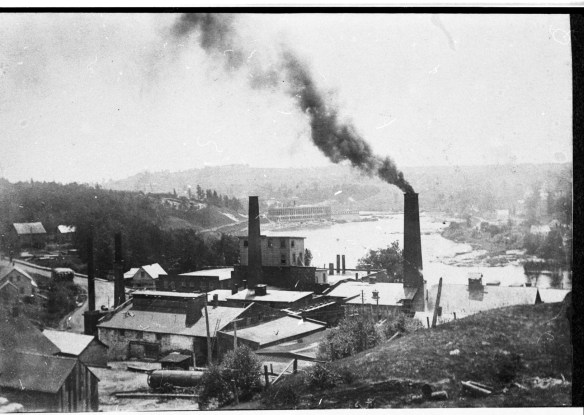
Over the course of 20 years (and three Canada censuses, 1861, 1871, and 1881), Philip’s occupation changed, he became more heavily involved in forestry, and he and his family moved to new localities within the region. In 1861, Philip was a cultivator in Ontario’s Durham County; in 1871, a lumberman in Quebec’s Windsor County; and, in 1881, a timber merchant in Quebec’s Southward County. Philip was a very large firewood producer, reporting 21,500 cords of firewood in the 1871 census when he was located in Windsor. Some of these 21,500 cords were probably extracted from the 161.8 ha of land he reported as owning. However, given the large amount, it is also probable that much of it came from other lands and that he was stockpiling the wood. Philip’s son George may have kept the books for his father Philip’s forestry-based business. Perhaps they were selling cordwood via railway to Montreal customers? Indeed, Philip frequented Montreal’s Albion Hotel, staying there every two to three weeks in the late 1870s and early 1880s, which suggests recurring business trips.[7] A decision in an 1878 Montreal court case showed Philip unscrupulous in an attempt to get land, probably for access to timber.[6] It may also be that the cordwood (no matter how he came by it) was sold to Windsor Mills, a pulp mill in the area that was owned by the Canada Paper Company (Figure 1b). Philip passed at 74 years of age in Maine, USA, and was put down as a lumberman in his death record.[8] His son George, who at some point had also moved to the United States, entered Canada in 1919 and, as reported in the 1921 Census of Canada, was working in Campbellton, New Brunswick, as the manager of a pulp company.[9] Fifty years previous to George’s entry to Canada (in 1871), George’s father Philip had been the “head” of a three-generational family: George was 11 years old at the time, and Philip’s father James who lived with them was 72. James, who was reported to be a farmer in the census, was probably farming the 16.2 ha occupied by his son Philip, and Philip, reported to be a lumberman, was working in forestry. Thus, within three generations, the work of the family had moved from farming, to a mix of farming and forestry, to the management of a forestry-based pulp and paper company. However, our energy profile of this operation illustrates the role of a farm during one year, 1871, of a life spent in wood.

Figure 1c. George N. Tackabury. Tackbury’s Atlas of the Dominion of Canada. Montreal: George N. Tackabury, 1876, https://numerique.banq.qc.ca/patrimoine/details/52327/2826692?docref=rsiL49VacNmlrwWjylX60g.

Figure 1d. Google Satellite Image of Windsor CSD and surrounding area.

Farm Energy Funds

In 1871, Philip Maher’s 16.2 ha of occupied land was one hundred percent cleared and virtually all dedicated to hay. However, because we do not know about the 161.8 ha that he owned outside the census division in which the 16.2 ha was located, we cannot ascertain how much of this second parcel was cleared. Nevertheless, we assume Philip was timbering the 161.8 ha and that when it was cleared of forest, he would sell it, perhaps to a settler recently arrived and in want of land.

Figure 2a. Area Visualization of Philip Maher’s 178 ha in 1871. Note that we have combined his two parcels to create this visualization. The green rectangle represents Maher’s hay. His .1 ha of orchard or gardens and his .1 ha of potatoes are barely visible. His developed land is 9.3 percent of the total available land, leaving 90.7 for his timbering work. Because he is not focussed on farming but, instead, on timbering, the area visualization does not look at all like that of a productive farm. Still, it is revealing that when Maher had a modest parcel of improved farmland, he dedicated the entirety of it to hay.
Figure 2b. Area visualization of all the farms in the Windsor CSD, Richmond, Quebec. This visualization contrasts strikingly with Maher’s visualization (as seen in Figure 2a). These farms are more developed than Maher’s, having hay, pasture, crops, and woodland. However, the farms are still largely undeveloped with 3,146.8 ha, or 63.3 percent in woodland, and 1,825 ha, or 36.7 percent, in hay, pasture, and crops. Moreover, the Windsor CSD as a whole is still largely undeveloped, with 4972 ha, or 30 percent, of the total land available in farms. The remaining 70 percent, though undeveloped, was still usable. It may be that citizens used the undeveloped available land as a vast woodland from whence to draw logs, for hunting, and for fishing.

Philip Maher did not have many animals, at least not on his home farm. He reported having one horse, two swine, three milk cows, and 12 sheep. The draught horses and/or oxen he would have needed in order to extract the cordwood from his 161.8 ha, plus these animals’ feed and litter, must have been reported by another person, perhaps a business partner or the owner of a company Maher was doing the work for, such as a pulp mill. Maher’s livestock intensity was 2.6 animals per km2. The absence of any pasture suggests that Philip’s farm animals loafed in a barn with internal divisions for his horse, swine, milk cows, and sheep. There may have been small paddocks adjacent to a barn for them, as well. The Windsor CSD’s livestock intensity was 4.1 animals per km2 and the grazing intensity was 0.73 ruminants per ha of pasture. Maher’s woodland, we suspect, was the 161.8 ha previously mentioned. The average-sized farm in the Windsor CSD had 26.44 ha of woodland. Maher reported a small garden that was .1 ha in size which is the same size of a garden or orchard for the average-sized farm in the Windsor CSD. Maher did not report any fruit products, so it is plausible that all of this .1 ha was vegetables.

Farm Energy Flows

Philip Maher had three crops, namely potatoes for his family and a small amount of turnips and mangel-wurtzel for his animals, probably his milchers who would benefit from an enriched diet. Conversely, crops grown in the Windsor CSD displayed a much greater variety. Farmers grew turnips (instead of mangels), potatoes, oats, barley, wheat, carrots and other root vegetables, tobacco, peas, apples and other fruits, turnips, beans, rye, buckwheat, and corn.

Maher had no pasture whatsoever, whereas the Windsor CSD had 709 ha of pasture, or approximately 6 ha of pasture per farm, when averaged. Maher had 16 ha in hay, which was 2.8 times greater than the average farm that had 5.7 ha in hay. The Windsor CSD had 677 ha in hay, overall. Maher’s feed deficit was 12,572 MJ, which would have been for the few animals housed on the 16.2 ha he occupied. In contrast, the feed deficit for the Windsor CSD was 15,372,774 MJ, or 129,183 MJ per farm. It may be that by keeping his number of animals low and by putting all his cleared land in hay, rather than combining it with pasture, he had a relatively low feed deficit. The mangels he grew would have supplemented the hay with roots throughout the winter. The remaining feed deficit could have been easily met by bringing in feed from elsewhere. The feed deficit of the average farm in Windsor CSD (129,183 MJ ) was ten times larger than Maher’s.

In 1871, the Philip Maher farm produced more slaughtered meat, except for mutton, and more butter and wool, than the average farm in the Windsor CSD. Maher reported slaughtering two cattle and two swine, and producing 300 pounds of butter and 50 pounds of wool. For the Windsor CSD, the average farmer slaughtered 1.2 cows, 4.1 sheep, and 1.3 swine per farm. The Windsor CSD also had 23,683 pounds of butter and 2,581 pounds of wool, which is 199 pounds of butter and 21.7 pounds of wool per farm. The Windsor CSD additionally produced 1,200 pounds of homemade cheese, 1,502 pounds of honey, 1,935 yards of homemade cloth or flannel, and 16,073 pounds of maple sugar. Maher’s reported 21,500 cords of firewood was 83.67 percent of the total 25,694 cords of firewood reported by the entire Windsor CSD. The average Windsor farm produced approximately 36 cords of firewood, which is more than the average household needed for cooking and warmth. Farmers could sell their surplus firewood to those in the area who needed it–professionals, such as teachers and lawyers, who may not have lived on farms. They may have also shipped their surplus wood via railway to supply Montreal with firewood, sold it to nearby pulp mills, or sold it to timber suppliers such as Philip Maher.

Conclusion

The Windsor CSD had poorer agricultural land than did townships located closer to the St. Lawrence River. This may be why the Windsor CSD was relatively undeveloped at the time the 1871 Census of Canada was taken. Philip Maher may have realized that because of poor soils farming in the area would never provide more than subsistence living. Montreal, an urban centre located approximately 100 km away by rail, was in need of firewood for cooking, heating, and industry and Maher may have set about to meet that need by providing firewood from his 161.8 ha of land. He may also have been supplying wood to local pulp mills. According to testimony given during a court case between the Canada Paper Company and the British American Land Company that took place May 26, 1882 stumpage was worth about $.20 cents per cord.[10] Maher’s 21,500 cords listed on his 1871 census return would have been worth, by 1882 prices, $4,300. Moreover, if one acre (.4 ha) of forest yields approximately 20 cords of wood, then Maher’s 21,500 cords represented 1,025 acres of deforested land. Finally, Maher’s 161.8 ha would have produced 8,000 cords, 13,500 less than he reported. Therefore, Maher must have had tickets to clear other tracts of land but was stockpiling the cordwood on his 161.8 ha parcel. Maher does not report any oxen or draught horses on his 16.2 ha. Thus, he must have outsourced this element of his forestry business. By keeping the number of his farm animals low, doing away with pasture entirely, and putting all his cleared land in hay, he was able to keep his feed deficit low. Being situated near a railway not only made it relatively easy to transport firewood, but it also made it relatively easy to acquire any grains needed to satisfy his animals’ feed deficits. Whereas a family farm provides a place to put down roots and for generations to live on overtime, the business of forest extraction does not necessarily offer the same advantage. As Maher moved from farming into the timber business, first as a lumberman, and later as a timber merchant, he and his family moved to new locations as stands of forest were cut and Maher sought new forests to exploit. Eventually, he moved his family to the State of Maine, just across the border from where he had conducted his Canadian business. Given that he had been in trouble with the law in 1878 over an unscrupulous acquisition of land (see note 6), one wonders if he left Canada, not only to continue and expand in forestry, but to leave the court’s jurisdiction and, thereby, avoid legal altercations.

Figure 6a. Map of the area showing railways in 1870, including the Grand Trunk Railway branch that passed through Richmond. Note the close proximity of Windsor to Montreal.

Figure 6b. Snip from “Hotel Arrivals,” Gazette, (Montreal, Que.), June 12, 1879. Philip Maher frequented Montreal’s Albion Hotel. It may be that he did business there. On this date, Philip and son George, both noted to be from Sherbrooke, are staying at the hotel.
Figure 6c. “Tenders for Fuel,” Gazette (Montreal, Que.), June 14, 1975. There was a market for firewood in Montreal. This advertisement is for coal and firewood for Montreal’s Court House and Gaol (Jail). In addition to 700 tons of steam coal, 275 cords of maple and birch (in equal measure), and 50 cords of tamarac were put out to tender. Having a mix of wood types in a wood pile was common because it helped to control the burn.

< Previous profile (Orser)

Next profile (Maltais) >


[1] “Philip Maher,” Maine, U.S., Death Records, 1761-1907, Ancestry.com. The death certificate form asks for the name and nationality of the parents of the deceased person.

[2] “Philip Maher,” 1881 Census of Canada, RG31, C-13199, Library and Archives Canada (LAC). Philip’s first wife Marie Anne Lemaitre dit Duhaime’s birth record confirms that she is Quebecois. See “Marie Anne Lematire Dite Duheme,” Quebec Vital and Church Records (Drouin Collection), 1621-1967, s.v. “Marie Anne Lemaitre dit Duhaime,” Ancestry.ca. Philip’s second wife Jane is listed as French in the 1871 Canada Census. See “Philip Maher,” 1871, LAC.

[3] “Philip Maher,” Ancestry Family Trees, Ancestry.ca.

[4] “Philip Maher,” U.S. Naturalization Record Indexes, 1791-1992,” Ancestry.ca.

[5] “Philip Maher,” 1871, LAC. George eventually married a Quebecois woman, Eva (Olivia), but in 1886, when his father Philip left for Penobscot, she would only have been 13 years old. See “George Maher,” Sixth Census of Canada, 1921, RG 31, Folder 34, Census Place 34, Restigouche and Madawaska, page 30, Ancestry.ca. George and Eva (Olivia) had two children, Margaret born in 1902 and George Jr. born in 1908.

[6] “Superior Court — Judgements,” Montreal, April 12, 1878,” Gazette (Montreal, Que.), May 2, 1878. In his search for land to timber, Philip Maher may have been unscrupulous. In the court case Henry Alymer vs Philip Maher, et al, he was found guilty by Judge Johnson of trying to defraud General (Henry) Alymer of Bath, England, of several lots and parts of lots in the Townships of Melbourne, Brompton, and Cleveland. Maher was in cahoots with Henry Alymer Jr. who had “sold” him the land sans any exchange of money without the knowledge of the General. Judge Johnson cancelled the nefarious deed of sale and ascribed costs to the two defendants.

[7] “Hotel Arrivals,” Gazette, (Montreal, Que.), June 12, 1879. Philip Maher frequented The Albion Hotel in the late 1870s and early 1880s. On this particular date both father and son, Philip and George Maher (indicted by the Gazette to be from Sherbrooke), were staying at the hotel.

[8] “Philip Maher,” Maine Death Records, Ancestry.com.

[9] “George Maher, Jr.,” Sixth Census of Canada, 1921, Ancestry.ca. The note that George Maher Jr. entered Canada in 1919 when he was 11 years old only comes up on his particular file. We assume that because of his young age, he arrived in Canada at the same time as the rest of the family. George’s obituary places him in Millinocket, Maine, USA at the time of his death. He was Director of the Public Works Department, and had been working there for 30 years. His wife, who survived him, was Jeannette. His parents were George and Olivia Maher (nee Roy). See “George Maher,” Death and Funerals, Bangor News, (Maine), August 19, 1976.

[10]  “Legal Intelligence,” Gazette (Montreal, Que.), May 26, 1882.

Energy on the John Orser Farm and Alnwick, Northumberland County, Ontario

Figure 1a. Terminus of the Cobourg & Peterborough Railroad at Harwood, Ontario, 1865. Cobourg and District Images collection of the Cobourg Public Library. Used with permission. Note the stacked cordwood on the dock that was fuel for the steamships plying Rice Lake. Click to enlarge.

The Orser Farm in Ontario’s Northumberland County is an example of a Forest Product Farm with Supporting Livestock and Crops. John Orser (b. 1808/ d. 1877) reported owning 220.5 acres, or 89.2 hectares, on “Orser’s Island, Rice Lake,” in 1871.[1] Orser’s Island was likely an early name for what is now White’s Island. Orser married Lucy Ann White April 1, 1836.[2] By 1871, the couple had four children: William age 29, David age 27, Martha age 24, and Gilbert age 22. A fifth child, 11-year-old Lucy White whom they had adopted, also lived with them.[3] Lucy was the daughter of Lucy Ann’s brother George White and George’s wife Marabah (nee Sickles).[4] Lucy was, therefore, Lucy Ann’s niece.[5] Her parents George and Marabah had recently relocated to Wiikwemikong on Manitoulin Island. The move was likely because particularly harsh weather of 1866 resulted in crop failures, and they chose Manitoulin in part because Maribah had band membership.[6] However, whereas John and Lucy Ann’s children were all in their 20s by 1871, George and Marabah’s children were all young (Figure 1b).[7] It may be that George and Marabah did not have enough help on the farm for it to be productive. After a few years at Wiikwemikong, George and Marabah relocated to Ten Mile Point, Manitoulin Island, and George timbered cedar and tamarack from the surrounding area. He supplied many of the squared railway ties for the Algoma Eastern Railway.[8]

Figure 1b. Maribah (nee Sickles) and George White and their sons Darius who is standing and William Norman who is sitting on his mother’s lap. This photograph, ca. 1866, is attributed to the Ten Mile Point Collection, courtesy of Harry Robbins. Ancestry Family Trees, Ancestry.ca.

The focus of this profile is on John and Lucy Ann Orser, the family that remained on Orser’s (White’s) Island. Like his brother-in-law, John mixed farming and forestry. In 1871, he reported 200 census standard pine logs, 20 census standard spruce or other logs, and 200 cords of firewood. This was the largest amount of logs and firewood reported by a landowner in Alnwick, in 1871.[9] Orser likely sold the firewood as fuel for the small steamships that plied Rice Lake (Figure 1a). It may be that he supplied cord wood to Zack (Zaccheus) White, his wife Lucy Ann’s cousin, to fuel Zack’s steamship The Firefly.[10] Orser also reported in the 1871 census that he owned two town building lots, two houses, three barns or stables, two cars, wagons, or sleds, five ploughs or cultivators, one thrashing machine, one fanning mill, and four of his own boats (described by the census only as pleasure or common boats).

Figure 1c. Clip showing location of White’s Island, previously Orser’s Island, Township of Alnwick. Illustrated Atlas of the Dominion of Canada, Containing All the Provinces, the Northwest Territories and the Island of Newfoundland. Toronto: H. Belden & Co., 1880. The Canadian County Atlas Digital Project, https://digital.library.mcgill.ca/countyatlas/searchmapframes.php.

Figure 1d. Google Map of Alnwick, Northumberland County, Ontario.

Farm Energy Funds*

At 89.2 ha, John Orser’s farm was more than double the average-sized farm in Alnwick (41.7 ha). As well, 77 percent of Orser’s land was cleared, compared to 40 percent of the Alnwick Census Subdivision (CSD). Additionally, his farm had five times more land in pasture and hay (37.2 ha) than did the average farm in the Alnwick CSD (7.3 ha). The livestock consuming these resources amounted to 23.4 units per square kilometer (LU/km2), with a grazing intensity of .66 ruminant units per hectare of pasture. In contrast, the Alnwick CSD contained 16.2 LU/km2 and a grazing intensity of 1.09 ruminants per hectare of pasture. Orser’s grazing intensity was a little lower than another Eastern Ontario farm profiled here (see the Yuill farm in Lanark County). This suggests that the island’s pastures, like the Yuill farm, were less productive than pastures in other parts of the country.

Figure 2a. Area Visualization of John Orser’s farm, in 1871. Note that approximately 23 percent (20.4 ha) of his land was either woodland or unimproved land and that approximately 30 percent (27.1 ha) was in pasture,11 percent (10.1 ha) in hay, and less than one percent (0.6 ha) in orchard and garden, leaving approximately 35 percent (30.8 ha) in potatoes, wheat and other crops. Clearly, Orser’s focus was on pasture and hay for his herd.
Figure 2b. Area Visualization of all the farms in Alnwick CSD, West Northumberland, Ontario. Approximately 35 percent of the land was either woodland or unimproved land, 23 percent was pasture, hay, orchard and gardens, or marsh, and 42 percent was potatoes, wheat, or other crops. This is a contrast to the Orser farm that had more land in pasture and hay but less land in woodland and unimproved land, as well as less land in potatoes, wheat, and other crops.

Farm Energy Flows*

With his relatively large wood production, Orser’s farm was an example of agri-forestry. In contrast to Orser’s 200 cords of firewood, the Alnwick CSD had 4,846 cords, or approximately 24 cords of firewood per farm. The wood he produced almost certainly came from forests beyond his own 20 hectares on the island. The Alnwick CSD contained another 2,364 hectares of woodland on farm holdings alone, plus a good deal of forest in non-agricultural holdings. In winter, when Rice Lake was frozen and men turned their attention to work in the woodlands, it was relatively easy to transport wood over ice by sleigh pulled by oxen or draught horses.

Both Orser and the greater Alnwick CSD had feed and litter deficits. In terms of energy, Orser’s feed deficit was 567,772 MJ and his litter deficit was 148,583 MJ. For the Alnwick CSD, it was 38,442,555 MJ and 10,786,178 MJ respectively, which was a 194,154 MJ feed deficit and a 54,476 MJ litter deficit per farm. Both Orser’s farm and the Alnwick CSD had residues from fodder crops and pasture, but the deficits meant that Orser and his neighbours had to bring in feed and litter to satisfy the requirements of their livestock. The railway that terminated at Harwood, which was just south-west of Orser’s, or White’s, Island plus the steamboats that plied Rice Lake, must have transported feed and litter to the Alnwick area, as well as transported farm products from Alnwick to larger centres.

In 1871, John Orser’s farm produced 180 bu spring wheat, 150 bu fall wheat, 100 bu oats, 300 bu peas, 200 bu potatoes, and 6 bu pears, plums, and other fruit. He also had two beehives. The Alnwick CSD produced the same crops, plus farmers from the area reported barley, rye, beans, buckwheat, corn, turnips, mangel-wurtzel, carrots, and other root crops. There were 34 beehives reported in total, which was approximately one hive for every six farms.

In 1871, Orser reported having two horses over three years old, six oxen, two milchers, fourteen other horned cattle, twelve sheep, and six swine. He slaughtered four each of cattle, sheep, and swine. He had 200 pounds of butter and 50 pounds of wool. For each of these categories the Orser farm exceeded the average farm in the Alnwick CSD. Most  notable was the number of livestock Orser had compared to the average farm in the area. For example, where Orser had six oxen, the average farm had .61 of an ox, and where Orser had 14 other horned cattle, the average farm had 3.62. The energy of the 12 animals Orser slaughtered (four each of cattle, swine, and sheep) was 8,200 MJ. In contrast, the energy of slaughtered cattle, swine, and sheep for the Alnwick CDS was 1,128,800 MJ, which averaged 5,701 MJ per farm.

Conclusion

John Orser’s farm was large and prosperous compared to the average farm in the Alnwick CSD. His adult children–three sons, William, David, and Gilbert, plus his daughter Martha and adopted daughter Lucy–provided labour on the farm. His sons must have also assisted Orser with the forestry that he undertook in winter. The six oxen kept by Orser, which amounted to three teams of two, allowed Orser and his sons to draw logs out of the forest and transport them to the Orser farm for storage. Although the 1871 Canada Census does not distinguish the breeds of any livestock, it may be that the two horses over the age of three reported by Orser were draught horses and that, therefore, they constituted a fourth team. By having pasture, hay, and other vital feed for his livestock, such as oats for his horses, and peas for his oxen, Orser’s farm supported his wintertime work in forestry.

* For an explanation of terms in this profile, see the farm energy profiles project home page.

< Previous profile (Yuill)

Next profile (Maher) >


[1] “John Orser,” 1871 Canada Census, RG31, C-9984, Library and Archives Canada (LAC), Ottawa.The enumerator noted that Orser was located on Orser Island, Rice Lake. The largest island in Rice Lake, White’s Island is approximately 99 ha. Possibly, ten hectares of White’s Island was owned by another person.

[2] “John Orser,” Ontario, Canada, Marriages, 1785-1935, Ancestry.com.

[3] “John Orser,” 1871, LAC.The enumerator also noted that Lucy White was an adopted child.

[4] “Maribah Sickles,” Ancestry Family Trees, Ancestry.ca.

[5] “George White,” 1861 Canada Census, C-1054, LAC. In 1861, George and Marabah White had four children, all girls. One-year-old Lucy was the youngest.  George’s mother and father, Martha and David, aged 66 and 77 respectively, were also living with them. Martha died about the time the census was taken, and David died in 1865.

[6] Michelle Caesar, “White family history letter a delight to read,” Manitoulin Express, June 27, 2018, https://www.manitoulin.com/letters-white-family-history-letter-a-delight-to-read/. The 1871 Canada Census for Alnwick shows that there were many Indigenous people (designated “Indian”) enumerated as well as settlers whose origins were put down by the enumerator as, for example, Scotch, Dutch, and English. Wiikewemkong is a First Nation located on Manitoulin Island. It is unceded territory. The enumerator also noted in schedule 3 of the 1871 census that one farm located in the same division as the John Orser farm had suffered from crop failure.

[7] “White,” 1861, LAC; and “George White,” 1881 Canada Census, C-13281, LAC. George White and his family are missing from the 1871 Canada Census, possibly because they were located on Wiikwemikong at the time. However, by combining the results of the 1861 and 1881 censuses, it is apparent that George and Marabah had several children by 1866, the eldest, Martha, was aged 13, and the youngest, William Norman was aged one. Marabah’s widowed father William Sickles was living with them in 1881 at the age of 90.

[8] Ibid.

[9] “John Orser,” 1871, LAC.

[10] Mary Jane Muskratte Simpson, “The Story of a Lake,” A History of the Rice Lake Indians,www.totemconsulting.ca, https://www.ricelakereserves.com/page29.html. An investigation using databases linked to Ancestry.ca shows that Lucy Ann and her brother George were descended from David G. White (b. 1784/ d. 1865) and that Zaccheus was descended from David’s younger brother Joseph C. White (b. 1786/ d. 1850). Both David and Joseph were born in the United States but had immigrated to Alnwick in the early nineteenth century. Ancestry.ca databases also indicate that Zack White was a “mariner.” See “Zacheus White,” Ontario, Canada, Deaths and Deaths Overseas, 1869-1948, Ancestry.ca. Ancestry.ca databases further show that Zack White’s father, also named Zaccheus, was involved in forestry. He is put down on his son Zack’s birth registration as a “lumber merchant.” See “Zacchens Ostrum,” Ontario, Canada Births, 1832-1915. s.v. “Zaccheus White,” Ancestry.ca. Zack’s mother’s maiden name was Ostrum. There has obviously been trouble transcribing this database so that some items are misspelled and others appear on the wrong line.