Energy on the Abraham Doras Shadd and Garrison Shadd Farm and the Raleigh CSD, Kent, Ontario

Figure 1a. Abraham Doras Shadd appearing on Canada Post’s 2009 54-cent postage stamp. An affluent free Black man and an abolitionist, Abraham was involved in helping Black refugees escape enslavement in the Southern Slave States as they fled north to freedom on the Underground Railroad. Our investigation of Shadd’s 1871 Census of Canada listing shows that, along with his many other accomplishments, he was a successful farmer and apiarist with extensive land in the Elgin Settlement, Raleigh, Ontario.

The Shadd farm in Ontario’s Raleigh CSD is an example of a Farm with Established Land Funds, High Non-Dairy Livestock Funds/Flows, and Specialized Animal Products (wool and honey). Abraham Shadd (b. 1801/d. 1882), an affluent free Black man and an abolitionist, was born in Wilmington, Delaware, but also lived in West Chester, Pennsylvania, before moving his family to the Elgin Settlement located in Raleigh Township, in 1852.The Elgin Settlement, also called the Buxton Mission, was a Black settlement that was designed primarily by Reverend William King, a white abolitionist from the United States who had also moved north to colonial Canada.[1] In both Delaware and Pennsylvania, Shadd had participated in the Underground Railroad, assisting Black refugees heading north to freedom. The Fugitive Slave Act passed by the United States Congress in 1850 was behind Shadd’s decision to bring his family further north into Canada West, later called Ontario. The 1850 Act meant that if fugitives were caught, they had to be returned to the slave-owner who claimed them as property and that officials and citizens of the Northern Free States were bound by law to cooperate–although, of course, many did not. Slave chasers were out in force, and the destination for refugees shifted further north across the border. Abraham Shadd had 14 children, several of whom became well known for their own achievements.[2] Shadd himself was the first Black man to be elected to public office in Canada West. Although some earlier references give the date 1859, Carolyn Smardz Frost gives 1862 as the date he was elected alderman for Kent County.[3] In addition to appearing on a commemorative stamp, Shadd was added to the Kent Agricultural Hall of Fame, and Centre Road, which ran through Buxton in 1881 was renamed A. D. Shadd Road in 1994 in his family’s honour.[4]

Figure 1b. Abraham Doras Shadd’s signature on the 1871 Census of Canada. Here he placed his signature on the census’s schedule 3, page 4, where he indicates that he had a total of 479 acres in the Dominion of Canada.

In 1871, Shadd was 70 years old and head of a 103 acre (41.7 ha) farm in Raleigh’s enumeration Division 3.[5] He was listed as a Quaker (“Friends”) and a farmer, and his origin was put down as African. In 1871, the total population of Raleigh CSD’s four divisions was 4,081 with 1,192 (29 percent) listed as African. In schedule 3 of the census, Shadd listed owning 479 acres (193.9 ha) total land in the Dominion of Canada, meaning that 376 acres (152.2 ha) were outside of Division 3. He also listed one town lot.[6] Shadd was also the 1871 Census of Canada enumerator for Division 3. His wife Harriet was 65, and an older woman, Mary, aged 89, lived with them, along with six-year-old Mary A., 14-year-old Andrew, and 23-year-old Eunice. A son, Garrison, who was 32 years old, owned 50 acres (20.2 ha) and a separate house and out-buildings in Division 3. Garrison lived with his wife Harriet, aged 30, and five children, the youngest six months old and the eldest seven. Garrison was listed as a Universalist and a farmer.[7] Garrison worked the land with his father Abraham, so for this energy profile we have combined the land of father and son with the understanding that the farm supported both families.[8] The Buxton National Historic Site & Museum is a treasure trove of historic material about Shadd and his family, and we encourage our readers to investigate their website. One online exhibit (an interactive site) that is particularly exciting to our energy profile is The Shadd Barn, where Abraham Shadd’s original barn, built in 1853, plus his tools may be viewed.[9] 

– Figure 1c. Images of the Abraham Shadd barn and homestead. Left: photo of the restored barn at the Buxton Museum. Top right: a virtual exhibit of the Shadd barn, Buxton Museum. Bottom right: an undated watercolour of the Shadd homestead. All photos used with permission of the Buxton Museum.

Figure 1d. Location of Range A, Lot 3, Raleigh. Illustrated Historical Atlas of the Counties of Essex and Kent, 1880-1881. Toronto, ON: H. Belden & Co, 1881. In the 1871 Census of Canada, schedule 4, Abraham Shadd indicated that his home farm was situated at Range A, Lot 3. Other sources indicate that Garrison’s property was further east on Concession 7, Lot 5. Both lots are shown within the green rectangle. Source: The Canadian County Atlas Digital Project. https://digital.library.mcgill.ca/countyatlas/Images/Maps/TownshipMaps/ken-m-raleigh.jpg

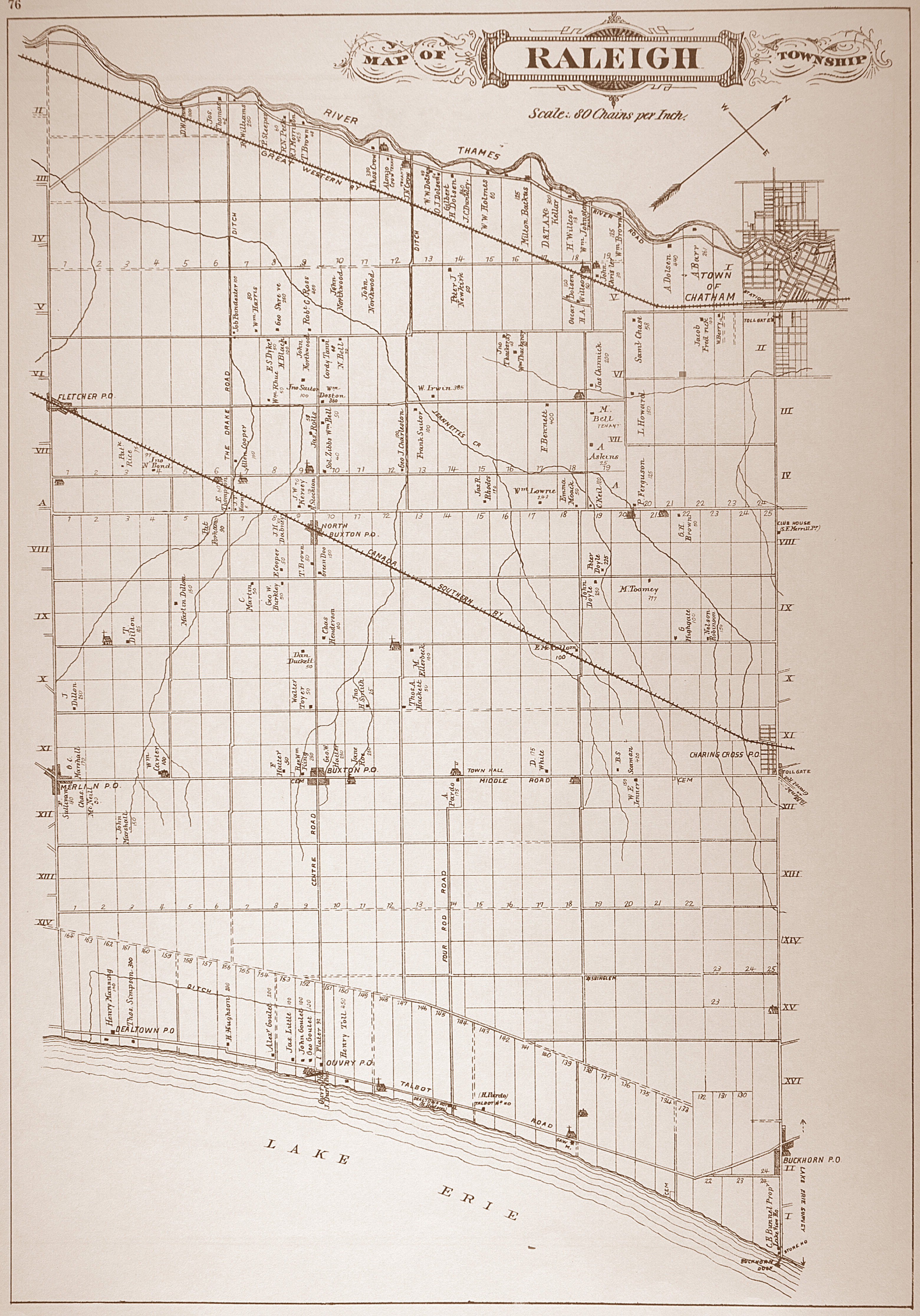
Figure 1e. Google Map of Raleigh, Kent, Ontario.

Farm Energy Funds

Abraham Shadd’s home farm (the 41.7 ha parcel) was one hundred percent improved, was intensively farmed, and probably supported two families. The first household was Abraham and Harriet and their four dependents, and the second was Abraham’s son Garrison, a farmer who had his own house and 20.2 ha elsewhere in Raleigh’s Division 3. Shadd’s home farm was larger than the average farm in the CSD which was 31.4 ha. Moreover, since the home farm was entirely cleared and the average farm in Raleigh was only 55 percent cleared, Shadd’s potential crop and fodder energy funds (41.7 ha) were much larger than average farm’s (17.2 ha). His hay land, pasture, gardens and orchards were roughly one-third of his land, with the remaining two-thirds in crops. However, his home farm was only about 21 percent of his total land, with most of his land being outside of Division 3. When Garrison’s 20.2 ha is added to Abraham’s total land, then the home farm is about 19.5 percent of their total land combined.

We assume that Abraham and Garrison made good use of their other land by way of sourcing wood and hay and possibly pasturing animals. Although Abraham’s and Garrison’s farms were located in Division 3, their other land was probably located throughout Raleigh’s three other divisions, and Shadd may have bought at least some of it from other settlers who put their land up for sale. In contrast, the Raleigh Census Subdivision (comprising four enumeration divisions) was in a much earlier stage of development than Abraham’s home farm. Just under half of farmland was still in forest, and the remainder was evenly divided between cropland on the one hand, and marshland, pasture, hay land, gardens, and orchards on the other. Abraham kept horses, colts or fillies, milk cows, other horned cattle, sheep, and swine. The Raleigh subdivision (CSD) reported the same livestock types, but Shadd had a greater emphasis on cattle than did the CSD. The livestock intensity of Shadd’s farm was 8.4 livestock units (LU/km2) and the grazing intensity was 1.65 ruminant livestock units per hectare of pasture on the home farm. For the Raleigh CSD, the livestock intensity was higher at 17.0 LU/km2, but the grazing intensity was lower at .82.

Figure 2a. Area Visualization of Abraham Shadd’s 41.7 ha home farm and his other lands that were outside Raleigh’s Division 3. Garrison Shadd’s 20.2 ha are included in the other lands. The Shadd home farm appears as the coloured rectangle, and the other lands appear in grey. Some of Shadd’s other lands may have been woodland, hay land, pasture, and/or cropland. His other land may have included farms that were rented to others, having purchased them from settlers who put their homesteads up for sale.
Figure 2b. Area Visualization of the Raleigh CSD which, with 9,182 ha in woodland, plus a greater amount of pasture (3,315.2 ha)  than hay land (1,727 ha), was still in an early stage of development. Note the emphasis on orchards and gardens (432 ha). In 1871, the CSD had 24,902 pounds of grapes, 28,407 bushels (bu) of apples, and 1,693.5 bu of pears, plums, and other fruit.

Farm Energy Flows

In 1871, the Shadd farm had 25 cords of firewood on hand which may have come from the 152.2 ha of other land that was separate from the home farm. The farm produced 117 bu of fall wheat, 150 bu barley, 17 bu oats, 30 bu peas, one bu beans, 100 bu corn, 20 bu potatoes, 3 bu turnips, 5 bu mangels and other beets, 3 bu carrots, one bu clover seed, 100 pounds grapes, 120 bu apples, and 5 bu of pears and/or plums. The Raleigh CSD reported the same crops as Shadd, plus spring wheat, buckwheat, rye, flax seed, hops, tobacco, and maple sugar. The Shadd farm had a feed deficit of 485,812 MJ and a litter deficit of 270,198 MJ. For the Raleigh CSD, the feed deficit and litter deficit were 236,780 MJ and 70,216 MJ per farm, respectively. Shadd’s feed and litter deficits were over three times greater than the average farm in the CSD.

The Shadd farm’s hay energy was less than its pasture energy, which was the same for the Raleigh CSD.The Shadd farm’s hay energy was 489,880 MJ and its pasture energy was 707,887 MJ. The CSD’s hay energy was 88,537,602 MJ and its pasture energy was 186, 768,382 MJ, which was 286,456 MJ (hay energy) and 135,794 MJ (pasture energy) per farm. The Shadd farm had more energy from hay and pasture than did the average from in the CSD.

In 1871, the Shadd farm had more livestock in all categories than did the average farm in the Raleigh CSD. Abraham and Garrison had two horses over the age of three, four colts or fillies, three milk cows, nine other horned cattle, 27 sheep, and 17 swine. They also had 14 beehives, the largest number of hives on a single farm that we have seen. They slaughtered ten horned cattle, three sheep, and 12 swine. The average farm in the Raleigh CSD had 1.8 horses over the age of three, .8 colts or fillies, 2.4 milk cows, 3.3 other horned cattle, 5.7 sheep, 6.3 swine, and .5 of a beehive. The average farm slaughtered one horned cattle,  4.3 sheep, and five swine. The CSD also had 34 oxen. Abraham and Garrison’s large number of beehives, plus their 100 pounds of reported honey, indicate that they were exploring these animals and their product, honey, for farm income, but probably also for pollination of their crops that required pollination by insects–their peas, apples, grapes, pears and/or plums. Jennifer Bonnell notes that the buffering effect of Great Lake water temperature on surrounding air masses, especially Lake Ontario and Lake Erie, “extended the growing season and supported the development of specialized ‘fruit belts’ that in turn provided excellent sources of pollen and nectar for bees.”[10] Abraham and Garrison Shadd may have been early apiarists benefitting from the unique microclimate created by Lake Erie’s water temperature on the air masses surrounding their farm. Abraham’s grandson William (Garrison’s son, see Figure 1g) “hived a swarm of bees,” 29 June 1884, showing that the apiary carried on after Abraham’s death (see Figure 6b).[11] The Shadd farm had 100 pounds of butter, five pounds of cheese, 110 pounds of wool, but no flannel cloth or linen. The average farm in the CSD, however, had 174 pounds of butter, 2.6 pounds of cheese, 3.4 pounds of honey, 25.7 pound of wool, but 7.3 yards of flannel cloth, and, as for Abraham and Garrison Shadd, no linen.

Conclusion

In 1871, Abraham and Garrison Shadd’s farm was prosperous and compares in land use to other farms we have portrayed in our Farm Energy Profiles series, such as Messier and Houle whose Quebec farms were of the same approximate size and were also 100 percent improved. What differs, however, is the very large amount of other land (152.2 ha) that was situated outside Raleigh’s Division 3. Abraham and Garrison Shadd and the Raleigh CSD produced the largest amounts of corn grain that we have seen so far. Most other parts of Ontario did not reach those levels until the twentieth century. Moreover, Shadd’s farm is the first we have seen with more energy from beef than from milk, and it is also the first we have seen with such a large number of beehives. Innovative apiarists, perhaps Abraham and Garrison Shadd were experimenting with their energy funds and flows to find a new approach that would make the best use of their land and the Elgin settlement’s warm microclimate. Certainly, their large number of beehives suggest that they were boosting pollination for their peas, apples, grapes, pears and/or plums. When Abraham Shadd made the decision to move his family north to the Elgin Settlement in 1852, he relocated to what was perhaps the final destination for many Black refugees fleeing the slavocracy of the United States. At Elgin, Abraham Shadd’s ingenuity flourished in a new locality, and he made his mark not only as the first Black man to be elected to public office in Canada West, but also by his success as a farmer and an apiarist.

Figure 6a. Apiary of William Coleman, Birr, Ontario, with Mr. Coleman in the background, ca. 1914. As is Chatham, Birr is located in southwestern Ontario. Although this is not a photograph of Abraham or Garrison Shadd, it gives an idea of how their apiary of 14 beehives may have appeared 35 years earlier, in 1871. Image courtesy of the St. Marys Museum and Archives, Ontario. https://images.ourontario.ca/stmarys/details.asp?ID=58029
Figure 6b. Diary entry (28 June 1884) by Abraham’s grandson William (Garrison’s eldest son) where he mentions that he, “Hived a swarm of bees.” Source: Rural Diary Archive (see footnote 11).

[1] Fergus M. Bordewich, Bound for Canaan: The Underground Railroad and the War for the Soul of America (New York, NY: Amistad, 2005), 389-394. Born in Ireland, King immigrated with his family to Ohio, where their farm became a station on the Underground Railroad. Later, he married the daughter of a wealthy slave-owning family based in Louisianna. When his wife died, he found himself her heir and the owner of 14 enslaved people whom he wanted to manumit. He travelled to Toronto where he gained the aid of the Presbyterian Synod, recruited 24 businessmen to oversee finances, and acquired an 18-square-mile (4,662 ha) tract of land near Chatham, Ontario, for a Black settlement. In honour of Lord Elgin, Canada’s Governor General at the time, the group of abolitionists was called the Elgin Association. The standard allotment was a 50-acre parcel. These were sold to Black settlers for $2.50 an acre, either by a lump sum payment or over time. King brought the 14 enslaved people he had inherited from his wife to the Elgin Settlement, and he gave them manumission papers when they crossed the border into Canada West. To learn more about the Underground Railroad in this area see: Chatham-Kent, “Chatham-Kent Underground Railroad,” (n.d) Accessed 23 Febuary, 2022), https://www.chatham-kent.ca/visitck/doandsee/heritage/undergroundrailroad/Pages/default.aspx

[2] Karolyn Smardz Frost, I’ve Got a Home in Glory Land: A Lost Tale of the Underground Railroad (Toronto, ON: Thomas Allen Publishers, 2007), 328. Mary Ann Shadd (Cary), Emaline Shadd, Issac Shadd, and Abraham Shadd were four of Abraham’s children who had many wonderful achievements, including the following: Mary Ann studied law at Howard University and later taught school in Washington, D.C.; Emaline became one of the first female professors at Howard University; Isaac, who had moved back to the Deep South, was elected to the Mississippi House of Representatives; and Abraham became a judge in Arkansas.

[3] Frost, I’ve Got a Home in Glory Land, 295.

[4] “Shadd, Abraham D.,” Kent Agricultural Hall of Fame, (Accessed 23 February 2022) https://www.chatham-kent.ca/aghof/inductees/Pages/Shadd,-Abraham-D.aspx.; “Abraham Doras Shadd,” Farms.com (Accessed 23 February 2022) https://www.farms.com/reflections-on-farm-and-food-history/lives-lived-archive/abraham-doras-shadd

[5] “Abraham Shadd,” 1871 Census of Canada, C-9891, Library and Archives Canada (LAC), Ottawa. Schedule 1, p20 line 5, https://data2.collectionscanada.gc.ca/microform/data2/dm13/d13/006003/c-9891/jpg/4396601_00174.jpg ; Other members of the family were listed as B. Methodists (Black Methodists) and members of the Church of England. Shadd’s grandfather, Hans Schad, was a Hessian mercenary soldier who fought for the British. Hans married a Black woman Elizabeth Jackson, and one of their sons, Jeremiah, and his wife Amelia Cisco, were Abraham’s parents. See “Shadd, Abraham D.,” Kent Agricultural Hall of Fame, (accessed 23 February 2022), https://www.chatham-kent.ca/aghof/inductees/Pages/Shadd,-Abraham-D.aspx.

[6] Shadd may have purchased land from other settlers when they put their land up for sale. A rule of the settlement was that for the first ten years of ownership, should a person decide to sell, he or she could only sell to another Black person. Eventually, white people moved into the area. The settlement school was free to attend, excellent, not segregated, and focussed on academics, including Latin and Greek. It attracted white students, including adults, who took seats in class alongside their Black neighbours. Bordewich, Bound for Canaan, 390, 392; Joyce Shadd Middleton recorded that Shadd owned land in Tilbury East and at least one town lot in Chatham, Ontario. Joyce Shadd Middleton, Bryan Prince, and Karen Evelyn, Something To Hope For. The Story Of The Fugitve Slave Settlement Buxton, Canada West (Buxton: Buxton National Historic Site and Museum, 1999).

[7] “Garrison Shadd,” 1871 Census of Canada, C-9891, LAC. Although Garrison had 50 acres, he did not list any crops, livestock, or wood products in the 1871 census’s schedule 4.

[8] Garrison kept a diary (1881-1889) with the assistance of his sons William, Alfred, Charles, and Issac, and there are many references to farm topics. See “Garrison Shadd Diary Collection,” Rural Diary Archives, (accessed 24 February 2022),  https://ruraldiaries.lib.uoguelph.ca/transcribe/collections/show/16

[9] The  Buxton National Historic Site & Museum website includes lovely and informative interactive sites, such as The Shadd Barn and the Buxton Schoolhouse. See, (accessed 24 February 2022), http://www.buxtonmuseum.com/

[10] Jennifer L. Bonnell (2020). “Insecticides, Honey Bee Losses and Beekeeper Advocacy in Nineteenth-Century Ontario.” Ontario History, 112(2), 141, https://www.erudit.org/en/journals/onhistory/2020-v112-n2-onhistory05560/1072234ar/

[11] “Shadd Diary & Transcription, 1881-1899: William Shadd, 1881-1885,” Rural Diary Archive, (accessed 24 February 2022), https://ruraldiaries.lib.uoguelph.ca/transcribe/items/show/232. See page 106.


< Previous Profile (Messier)

Next Profile (Pawling) >

Energy on the Marguerite Messier Farm and the St. Hyacinthe CSD, St. Hyacinthe, Quebec

Figure 1a. Simone Durant holding cured leaves of cigar, left, and cigarette tobacco leaves, in Joliette, Quebec, 1949. Like St. Hyacinthe in the nineteenth century, Joliette became part of Quebec’s tobacco producing region in the early twentieth century. Although this photograph was taken long after Marguerite Messier grew tobacco on her farm in St. Hyacinthe, it shows a woman participating in this branch of agriculture, not unlike Messier almost a century earlier. Library and Archives Canada/National Film Board or Canada fonds/e011175785, https://recherche-collection-search.bac-lac.gc.ca/eng/home/record?app=fonandcol&IdNumber=4948554&new=-8585570900960126382

The Messier farm in Quebec’s St. Hyacinthe CSD is an example of a Farm with Average Land Funds (land and pasture), Low Livestock Funds/Flows, and Specialized Cash Crops (tobacco) and Animal Products (wool and honey). In terms of its land size and crop energy flows, the Messier farm was almost the perfectly average farm in the CSD. It is in many ways a typical operation for this region.[1] It stands out in one important respect, however, because it was owned by a woman. In 1871, 59-year-old Marguerite Mefsier (Messier), a widow, was head of the 36.4 hectare (ha) farm.[2] Marguerite’s husband Michel died in 1865 at 58 years of age.[3] She continued to farm the completely cleared parcel, and like many farms in the region she produced cash crops such as tobacco and surplus cereals. In other ways, the Messier farm was smaller than average, such as its lower number of livestock and the flows they generated.

Her two sons Améde and Antoine, ages 23 and 19, were farmers who must have done much of the farm work. A second family of the same surname, Messier, lived with them in the same house. This was 38-year-old Michel, who was a commis (or clerk), his wife Marie who was 35, and their five children, Joseph, Albina, Georges, Jean, and Ema, ages 13, 11, eight, four, and two. In the 1871 Census of Canada Michel did not report any land, livestock, crops, or products. Although we do not know the exact relationship between Marguerite’s immediate family and Michel and his family, they were probably relatives–possibly her eldest son, daughter-in-law, and grandchildren–who lived at the farm as family members or as boarders and who pitched in to get work on the farm done. The farm was successful because of Marguerite’s good fortune to have extensive pastures and other cleared land as well as family labour to work it. Her two adult sons, plus Michel, Marie, and probably Ema, their eldest child, all could have contributed labour. This was not the case for all women, of course. Another widow whose farm we examined in St. Hyacinthe, Esther Beauregard, was not nearly as well supported as was Marguerite. Esther, who had three young children, the eldest deaf, lost her farm and ended up in Hotel Dieu of St. Hyacinthe where nuns cared for the poor. Esther died impoverished at 60 years of age.[4]

Marguerite had an additional 12 ha in the Dominion of Canada that was outside the census subdivision in which she lived.[5] This additional 12 ha was likely close by to her 36.4 ha and used as a woodlot or, if it was improved, she may have had more pastureland, hay land, and cropland available than reported in Schedule 1 of the 1871 Census of Canada. When combined, Marguerite’s two parcels of land totaled 48.4 ha.

Figure 1b.  Carte du comté de St. Hyacinthe construite d’après les plans du Cadastre. 1:63:360. Bibliothèque de Archives nationals du Québec, 1930. Approximate 1871 CSD boundary shown in green. https://numerique.banq.qc.ca/patrimoine/details/52327/2244832

Figure 1c. Google Map of St. Hyacinthe, Quebec.

Farm Energy Funds

Marguerite Messier’s 36.4 ha was one hundred percent improved, was intensively cropped, and supported either one large family or two smaller families. Marguerite divided this parcel’s improved land roughly by thirds: 12.1 ha was in pastureland, 12.1 ha was in hay land, 9.8 ha was in cropland, and the remaining land was in gardens, orchards, buildings, and lanes. In contrast, the St. Hyacinthe CSD’s 9,747 ha was not completely improved, but had 1,363 ha in woodland with the remaining 8,381 ha improved. The CSD’s improved land was not evenly divided by thirds, as was the Messier farm. Instead, the hay land was proportionately smaller and the cropland larger so that the profile of the St. Hyacinthe CSD was 2,750 ha (32 percent) pastureland, 1,187 ha (14 percent) hay land, and 4,353 ha (53 percent) cropland, with the remaining 93 ha (one percent) dyked marshland, gardens, orchards, buildings, and lanes. The Messier farm was slightly larger than the average farm in St. Hyacinthe (34.4 ha); but, with the 12 ha that lay outside her CSD Marguerite had access to a bit more land than the average farmer in St. Hyacinthe. Marguerite kept horses, milk cows, and sheep, but she also had one other horned bovine and one pig. The greater region of the St. Hyacinthe CSD reported the same livestock types as the Messier farm with a similar emphasis on milk cows and sheep over other horned cattle and swine. The livestock intensity of the Messier farm was 17 LU/km2 and the grazing intensity was .35. In contrast, the St. Hyacinthe CSD was higher at  23.9 LU/km2 and .59 respectively. The Messier farm had a lower grazing intensity because proportionally it provided more pasture for its animals to graze upon and, as discussed in the next section, the farm had less livestock than the average farm in St. Hyacinthe.

Figure 2a. Area Visualization of Marguerite Messier’s farm in St. Hyacinthe, Quebec, 1871. Marguerite Messier’s 36.4 ha is represented by the coloured rectangle, and her 12 ha is represented by the grey area that surrounds it. Her 36.4 ha is one hundred percent improved, with about two-thirds in pastureland or hay land and the remaining third in cropland.
Figure 2b. Area Visualization of the St. Hyacinthe CSD shows that it was in an earlier stage of development than Marguerite Messier’s farm: approximately 20 percent of the available land was still wooded, and of the remaining 80 percent half was in fodder and half in cropland. About two-thirds of the fodder was in pastureland and one-third in hay land. As farms develop, often pastureland appears first, followed by hay land. Still, St. Hyacinthe’s agroecosystem was approaching the limits of land clearing, and the remaining forest was likely valued for firewood and other critical forest products.

Farm Energy Flows

In 1871, the Messier farm had 60 census standard red pine logs on hand, as well as 19 cords of wood. Likely these forest products came from the 12 ha that was outside the census subdivision in which Messier lived. The farm produced 70 bushels (bu) oats, 122 bu potatoes, 65 bu barley, 14 bu wheat, five bu peas, seven bu buckwheat, 30 bu corn, and ten pounds of tobacco. The St. Hyacinthe CSD reports the same crops as Marguerite Messier, plus beans, turnips, beets, carrots, grapes, apples, pears and/or plums, and maple sugar. The Messier farm had a feed deficit of 279,555 MJ, and a litter deficit of 83,841 MJ. For the St.Hyacinthe CSD, the feed deficit was 392,523 MJ per farm, and the litter deficit was 93,011 MJ per farm. Marguerite’s feed demand was 95 percent fodder, and with a very small hay crop in 1870, we see that even the residues from her grain crops failed to make up the feed deficit. It may be that Messier met her feed and litter requirements that year by feeding her surplus grains to the animals, or, more likely, by selling or trading them with neighbours who had feed and litter to spare. Certainly, her ten pounds of tobacco, a lucrative cash crop, would have put money into her hands.

The Messier farm’s hay energy was less than half of its pasture energy which were 130,635 MJ and 293,349 MJ respectively. There were 224,360 MJ of residues, and the farm reused all of its fodder. For the St. Hyacinthe CSD, the hay energy (32,838,273 MJ) was about one-third of its pasture energy  (110,650,816 MJ). There were 81,506,961 MJ of residues and the CSD reused all its fodder.

In 1871, the average farm in the St. Hyacinthe CSD had more livestock than did the Messier farm. Marguerite Messier had two horses over the age of three, two colts or fillies, three milk cows, one other horned bovine, eight sheep, and one swine. The farm either butchered or exported the one horned bovine, four sheep, and three swine.[6] These low, and apparently declining numbers combined with the low grazing density on her extensive pastures suggest that Marguerite was reducing the size of her herds. For comparison, and based on St. Hyacinthe’s 283 farms, the average farm in St. Hyacinthe had 2.5 horses over the age of three, .8 colts or fillies, 3.7 milk cows, 13.3 sheep, and 3.4 swine, and butchered or exported 1.6 horned cattle, 6.1 sheep, and 2.9 swine.

Marguerite may have been reducing her dairy produce and specializing in other animal products, such as those from bees and sheep. This is reflected in the yields she reported for her butter, honey, and wool, and her lack of cheese. The average farm in the CSD had slightly more than twice as much butter than did the Messier farm. Marguerite reported 50 pounds of butter, but the average farm in the CSD had 104.The tables were turned, however, when it came to honey and firewood. The Messier farm had one beehive, 40 pounds of honey, and 19 cords of firewood, but the average farm in the CSD had .8 beehives, 7.6 pounds of honey, and 7 cords of wood. Where the Messier farm and the CSD are more or less on equal footing is wool. Whereas the Messier farm had 30 pounds of wool, the average farm in the CSD had 28.9. Marguerite processed some cloth from the wool, although she likely sold much of the wool to others. The average farm in the CSD had 33.3 yards of homemade cloth, whereas the Messier farm had 25. One product that the Messier farm lacked completely was homemade linen. The CSD reported 3,543 yards of homemade linen, or 12.5 yards per average farm, but the Messier farm reported none.

Figures 5a and 5b. Livestock and Barnyard Produce for the Messier farm and the St. Hyacinthe CSD. The Messier farm and the St. Hyacinthe CSD have very similar patterns in regard to livestock and products from livestock.

Conclusion

Marguerite Messier’s 48.4 ha farm was larger than the average farm in the St. Hyacinthe CSD, yet her crop and animal energy flows were smaller. Her evenly divided pastureland, hay land, and cropland suggest a rotation of crops, possibly on a plan similar to that of the Maltais brothers whose farm we previously highlighted in this series of farm profiles. In year one the Maltais brothers’ fields were sown with cereals, in years two and three those same fields were used for hay, and in years four and five they were used for pasture. The Messier farm’s three milk cows produced enough milk and butter for the people living on the farm, and the slaughtered animals would have been meat for the table. Beyond providing sustenance to those living on the farm, Marguerite’s focus was wool and tobacco. All in all, Marguerite’s approach to operating her farm was balanced, as can be seen with her diverse crop types, probable crop rotation, and her reduced livestock density. Her farm was also multi-generational, and with a single woman as the matriarch it is perhaps not surprising that she appears to have been focusing her energy strategy on wool and tobacco, and perhaps even honey. With Michel working off the farm as a commis, or clerk, the frame for the farm becomes pluri-occupational as his wage would contribute to the farm’s economy. Ultimately, the Messier farm was successful because Marguerite, her sons Améde and Antione, plus Michel, Marie, and their eldest child Ema, provided needed labour. The photo of Simone Durant holding cured tobacco might have been taken 78 years later, but in some ways we see a little of Margeurite in her portrait.

Figure 6a. Workers storing cured tobacco in a Quebec barn, 1949. Library and Archives Canada/National Film Board of Canada fonds/e011175786, https://recherche-collection-search.bac-lac.gc.ca/eng/home/record?app=fonandcol&IdNumber=4948555&new=-8585570900960126382

[1]  Previously, we have written about farms that were exceptional. For example, we have written about farms that eventually won gold in Québec’s Concours Provincial de Mérite Agricole (Agricultural Merit Contest) of the early twentieth century. The Thomas Maltais farm of Jonquiere, Quebec, and the Edouard and Edmund Houle farm of Nicolet, Quebec, both won gold, for example. We have also written about farms that were exceptionally large, such as the Christian B. and Joseph Snyder farm of North Waterloo, Ontario. A third category we have written about is farms with exceptional products, such as the Philip Maher farm in Windsor, Richmond,Quebec, whose farm was actually a timber extraction enterprise. Finally, we have profiled farms whose owners were listed in the Dictionary of Canadian Biography, such as the diminutive-in-size (5.3 ha) Andrew Hay Johnson farm of Falmouth, Nova Scotia.

[2] “Marguerite Mefsier,” 1871 Census of Canda, RG31, C-10065, Library and Archives Canada (LAC), Ottawa.

[3]  “Michel Messier,” Quebec, Canada, Vital and Church Records (Drouin Collection), 1621-1968, Ancestry.ca. Marguerite’s husband Michel died at age 58 and was buried on 18 November 1865.

[4] “Esther Beauregard,” 1871 Census of Canada, RG31, C-1005, LAC. See also Esther’s death certificate: “Esther Beauregard,” Quebec, Canada, Vital and Church Records (Drouin Collection), 1621-1968, Ancestry.ca. Esther died 7 February 1887. Esther’s husband Irénéé Beauregard appears in the 1861 Census of Canada, but does not appear ten years later when the 1871 Census of Canada was taken. Therefore, he died after 1861 but before 1871. Esther and her children are listed in the 1881 Census of Canada. They are living (along with dozens of others) in a religious poor house, probably the Hotel Dieu of St. Hyacinthe.

[5] “Marguerite Mefsier,” Schedule 3, 1871 Census of Canada.

[6] For the 1871 Canada Census, slaughtered or exported animals were counted over and above the head count for the animals on a farm. For example, Messier’s one swine plus three slaughtered or exported swine meant the swine herd had been four animals in 1871 and that 75 percent of the herd had been slaughtered or exported. The one animal that was not slaughtered or exported was probably a sow.


< Previous Profile (Houle)

Next Profile (Shadd) >