A Walk on the Edge – Andrew MacPherson
A Long Run Along the Edge – Andrew MacPherson
I’ve decided to take this assignment in a slightly different direction. I strongly believe in the power of liminal spaces. I live in one in Calgary, less than 200 metres from the Bow River. This is mostly fine and I enjoy walking and running along the river often, including almost daily visits to two nearby river islands, Prince’s Island which was man-made for the logging industry over a century ago and St. Patrick’s Island which is home to the Calgary Zoo.
Similarly, when I’m on PEI I spend most of my time at my cottage on the shore of New London Bay, and before that for many years we rented cottages in Argyle Shore. For a decade of my childhood and adolescence I was a camper and later worked at Camp Keir when it was in French River and later after it moved to Canoe Cove. My grandparents’ mixed farm had river access in Oyster Bed Bridge from which my Matheson ancestors built and sailed ships.
There is amazing positive energy in these liminal spaces but also a great deal of risk, particularly in these days of the global climate crisis. Both my neighbourhood in Calgary and my cottage community in New London have faced flooding three times in the past decade. I am nonetheless drawn to these places.
During the first months of the global Covid-19 pandemic my running habits changed greatly. In Alberta we never had a real lockdown, but we were of course reminded to keep a 2-metre separation with others and encouraged not to leave our neighbourhoods unnecessarily. This resulted in me modifying my running routes along the river because although we have an amazing pathway system in Calgary, it became very busy and almost impossible to maintain social distancing especially while running. This led me to repeatedly run a 5-kilometre, 40-block pattern in my neighbourhood where I could run on the street when needed to avoid people on the sidewalk. This was easy because the streets were so quiet as no one had anywhere to go in their cars. This became monotonous, so I devised a creative solution to make it more interesting.
At the same time, we were wondering whether we would make it to PEI in 2020. As seasonal residents it became clear that there could be an opportunity because we would have a place to self-isolate, but the island was being very protective of its borders and careful about its elderly population and limited health care system.
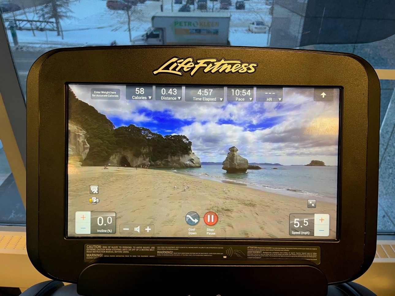
My solution to both problems was to virtually run the coastline using Google Streetview. Each day I would do my run then come home and trace that distance along the road. On cold days in the winter when I don’t feel like running outside, I run on the treadmill at the gym at work. We have treadmills equipped with a television screen and preloaded runs you can do on routes in California, Germany and New Zealand, including the photo below from Cathedral Grove. I’m able to visit the edge virtually on even the coldest winter day in Calgary if I want to. This was another inspiration for this activity.
When I’m on the island and want to go for a run in Charlottetown I like to park near the pool in Victoria Park and start my run along the boardwalk. So, this was my start and end point for my virtual run around the island.
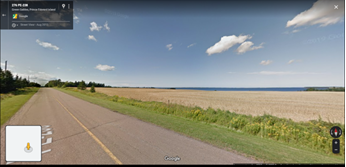
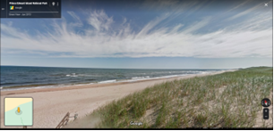
Overall, I was able to run over 1000 km virtually over the course of about six months. Google Streetview is mostly limited to paved roads (with the notable exception of Greenwich; see picture below) but I was still able to get out to the edge quite often. Since I did my virtual run around the island, a 700-kilometre route is being marketed as a walk. Last summer I saw some people attempting it.
Some major takeaways from me were slowing down and seeing the island at a slower pace than I usually experience in a car. I was also able to run in places like Lennox Island and the Tignish Run where I would normally feel comfortable. Running the island virtually also had the advantage of being safer than cycling or running the narrow country roads in real life. I visited places like Launching and Northport that I have no memory of going to before. The place names I encountered each day were often beguiling, with destinations such as runs from White Sands to Guernsey Cove and Point Prim to Pinette.
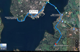
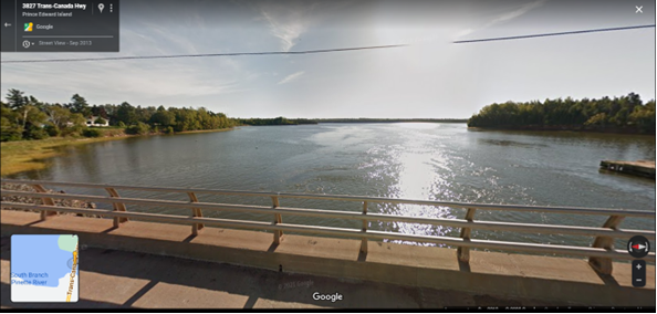
However, there is one other aspect of the virtual run I didn’t expect, and that was the role bridges play in allowing us to cross the island. We take them for granted but they make all of our trips much shorter and they have the most amazing views if you can manage to stop and look at them. Some of the best are the Grand River in Prince County, Pinette (pictured below) in King’s County and the West River on the south shore in Queen’s County.
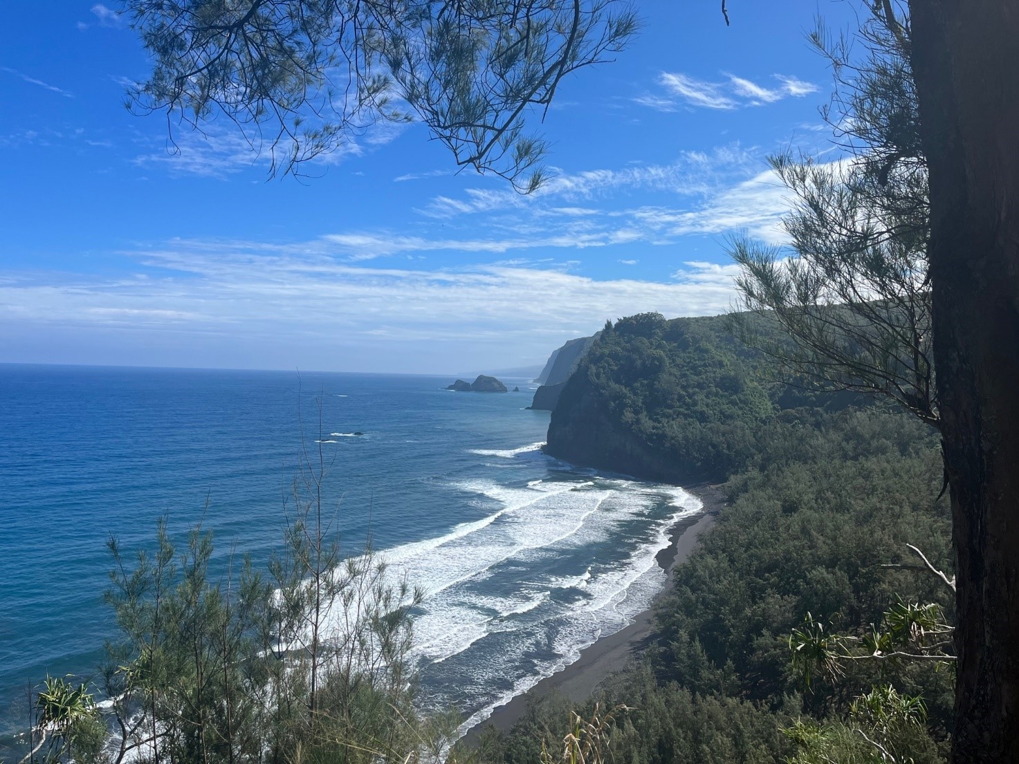
A last observation about virtual visits versus in person. We recently visited the Big Island of the Hawaiian archipelago. There were some beaches like the Pololu valley, pictured below, that are sacred burial sites for indigenous people where tourists are still allowed to hike down to. There are others like the Waipi’o Valley that are now closed to tourists.
In this age of increased consciousness about air travel and indigenous rights there may increasingly be places we should only visit virtually rather than in person. In Cloud Cuckoo Land, a recent novel by Pulitzer Prize-winner Anthony Doerr, these kinds of virtual visits to historical places play a significant role. Characters in the novel visit locations in the past using this technique. Perhaps this could solve some of our problems if we could accept it more.