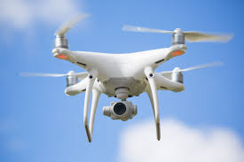
Instructors:
Adam Fenech, University of Prince Edward Island
Andrew Clark – University of Calgary
Paul Nesbit – University of Calgary
Description:
- How to purchase a UAV, the various models
- How to plan drone flights, and operation options
- Options and procedures for image processing
- How to establish ground control points to increase the precision of data captured
- Understanding scale considerations for answering research questions
- The Department of Transport rules and regulations for operating UAVs
- How to operate UAVs safely
Schedule:
Monday July 23
0830 Introduction to UAVs
0900 UAV for Coastal Monitoring on the Canadian Coast
1000 Geologic Mapping using UAV at Dinosaur Provincial Park, Alberta
1030 Break
1100 Spec’ing a UAV System
1200 Lunch
1300 Presentation by Roger Smith from Transport Canada on rules and regulations governing the application of drone technology to research activities, as well as the ins-and-outs of applying for a Special Flight Operating Certificate
1430 Break
1500 Flight Planning, Scale, Ground Control
1630 End of first day sessions
Tuesday July 24
0830 In Field Drone Flight Demonstration and Data Collection – Belle River, PE
1200 Lunch
1330 Structure from Motion
1400 Image Processing
1430 Break
1500 Data Visualization and Interpretation
1600 Final Questions and Discussion
1630 End of Final Day Session
Wednesday July 25
Rain date for Field Drone Flight Demonstration
Biographies of Instructors
Dr. Adam Fenech, University of Prince Edward Island – Dr. Fenech has been engaged in climate change research for thirty years starting with the 1988 Toronto Conference on the Changing Atmosphere which launched the climate change issue into the international policy agenda. Dr. Fenech was an inaugural member of the Intergovernmental Panel on Climate Change, a group that shared in the 2007 Nobel Peace Prize. Dr. Fenech has written policy speeches for Canadian Environment Ministers, represented Canada at international environmental meetings, and teaches regularly at universities across Canada and around the world. Presently, Dr. Fenech leads the UPEI Climate Research Lab where his graduate students use drone technology in their climate change research.
Andrew Clark, University of Calgary – Mr. Clark is a PhD student at the University of Calgary. Mr. Clark is the main programmer of the internationally-recognized sea-level rise visualization known as CLIVE (CoastaL Impacts Visualization Environment). CLIVE has won numerous awards including one from the prestigious Massachusetts Institute of Technology (MIT). Mr. Clark is the main pilot of the UPEI Climate Lab drones, and leads research in their application in the environmental sciences.
Paul Nesbit, University of Calgary – Mr. Nesbit is a PhD student at the University of Calgary. Mr. Nesbit’s research focuses on the application of UAVs and processing solutions. He holds a Masters of Science in Geographic Information Science and Geography from California State University-Long Beach.

