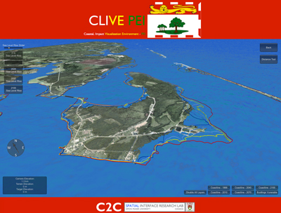
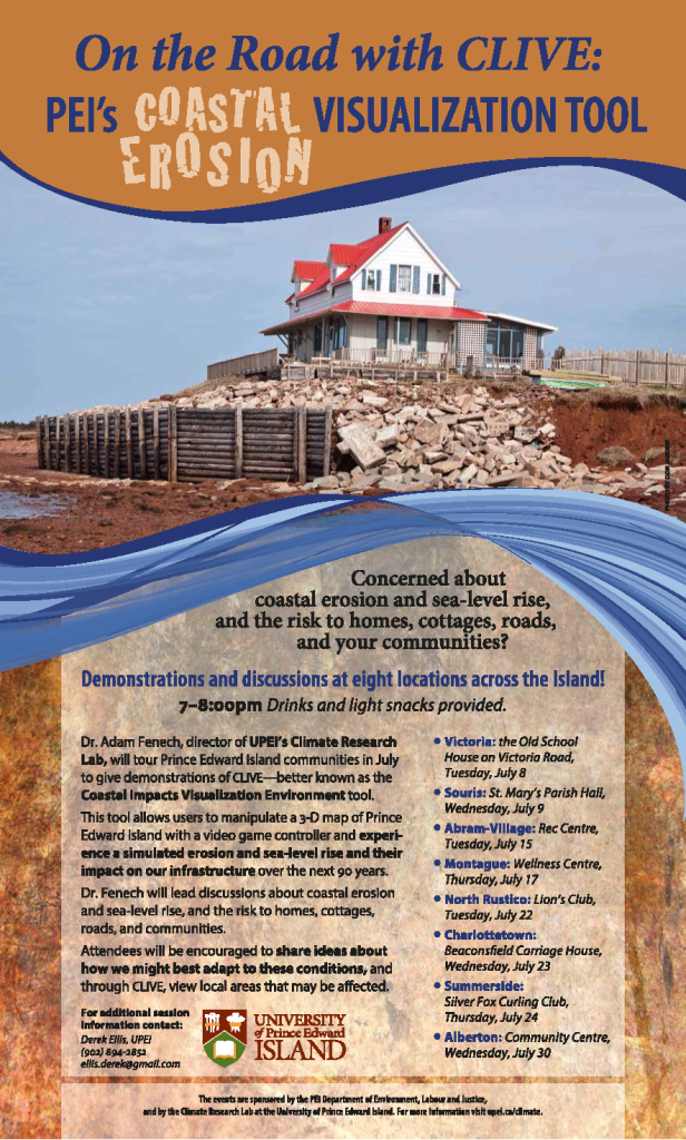
Dr. Adam Fenech, director of UPEI’s Climate Research Lab, will tour Prince Edward Island communities in July to give demonstrations of CLIVE – better known as the CoastaL Impacts Visualization Environment tool.
This tool allows users to manipulate a 3-D map of Prince Edward Island with a video game controller and experience simulated erosion and sea-level rise and their impact on our infrastructure over the next 90 years.
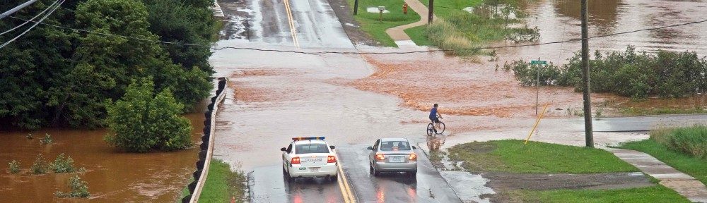
Dr. Fenech will lead discussions about coastal erosion and sea-level rise, and the risk to homes, cottages, roads, and communities.
Attendees will be encouraged to share ideas about how we might best adapt to these conditions, and through CLIVE, view local areas that may be affected.
Demonstrations and discussions will be held at 8 locations across the island, as follows:
Tuesday, July 8 Victoria, the Old School House on Victoria Road
Wednesday, July 9 Souris, St. Mary’s Parish Hall
Tuesday, July 15 Abram-Village, Rec Centre
Thursday, July 17 Montague, Wellness Centre
Tuesday, July 22 North Rustico, Lion’s Club
Wednesday, July 23 Charlottetown, Beaconsfield Carriage House
Thursday, July 24 Summerside, Silver Fox Curling Club
Wednesday, July 30 Alberton, Community Centre
Each presentation will run from 7:00-8:00pm, with drinks and light refreshments provided.
The events are sponsored by the PEI Department of Environment, Labour and Justice, and by the Climate Research Lab at the University of Prince Edward Island.

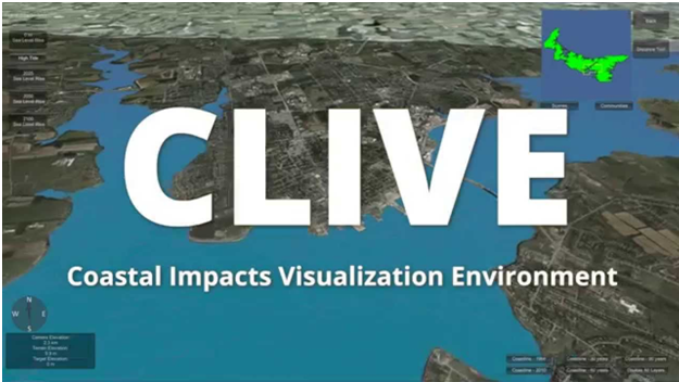 CLIVE is the Coastal Impacts Visualization Environment, a sea level rise and coastal erosion video game, which allows users to fly over Prince Edward Island raising and lowering the sea level and turning on/off coastal layers to identify areas of risk and vulnerability.
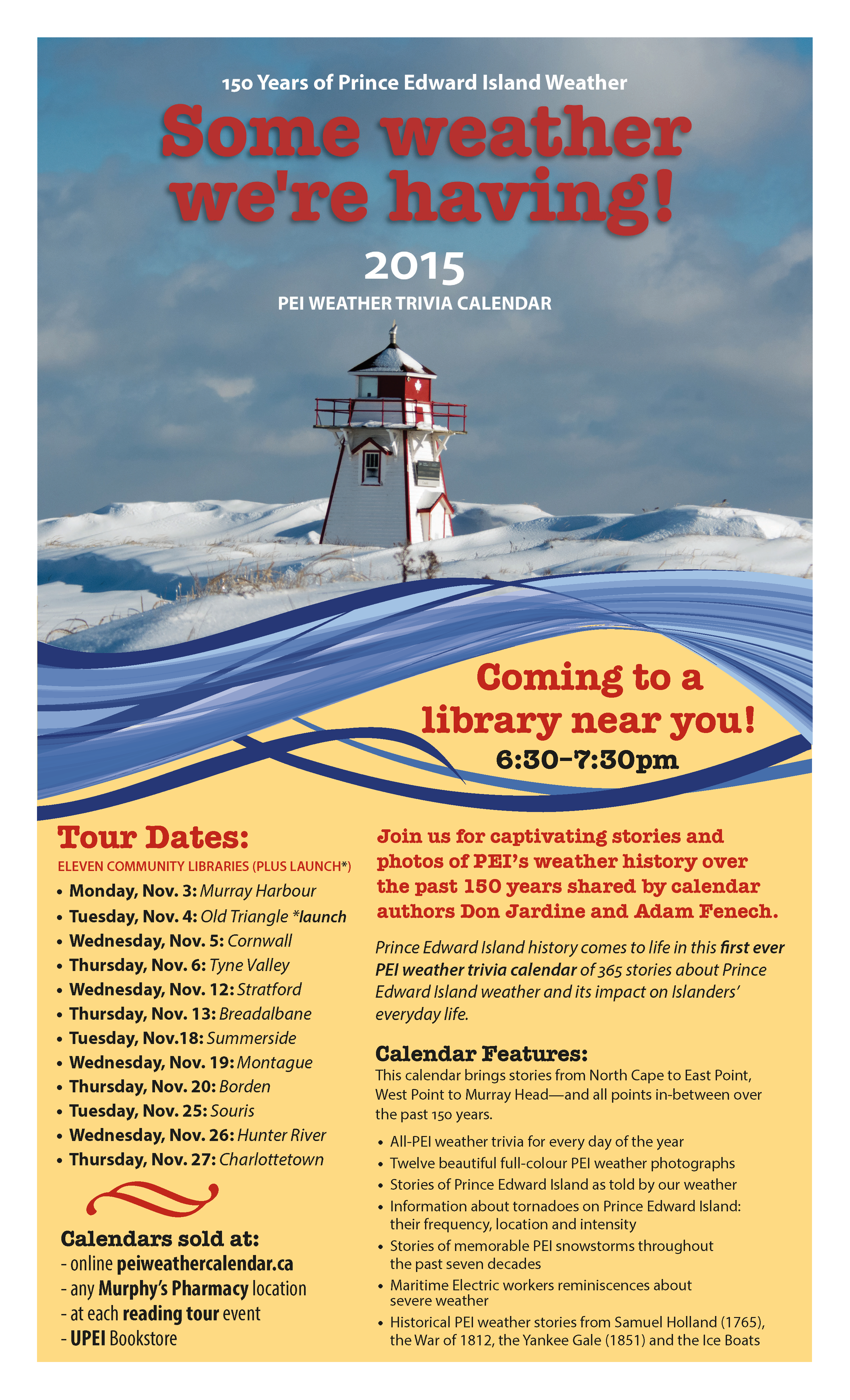
 adcast meteorologist Peter Coade will join authors Don Jardine and Adam Fenech for the launch of “Some weather we’re having!” The 2015 PEI Weather Trivia Calendar. The event takes place Tuesday, November 4 at 6:30 pm at The Pourhouse, above The Old Triangle Irish Alehouse in Charlottetown. Proceeds from calendar sales go to UPEI’s Climate Research Lab.
 Prince Edward Island history comes to life in this first ever PEI weather trivia calendar of 365 stories about PEI weather and its impact on Islanders’ everyday lives. Meet the authors, Don Jardine and Adam Fenech, as they visit eleven libraries (and one pub!) across the Island during the month of November.