
Provincial Coastal Erosion Monitoring Project
The Climate Research Lab maintains and operates two coastal change monitoring programs across the Province; a traditional terrestrial monitoring method using peg-line measurements, and an emerging method using sUAS (small Unmanned Aerial Systems).
Coastal Monitoring Program – Peg-line Measurements
 In 1984, a coastal erosion monitoring program was established by the Department of Community and Cultural Affairs Marine Environment Section to understand the impact sand mining was having on coastal erosion rates. This program was abandoned in the 1990s and in 2014 the Climate Research Lab obtained original field notes and resurrected the program. An improved method for more accurate measurements was implemented and additional sites established in subsequent years. The Climate Lab now maintains over 100 measuring locations at over 50 study sites across the Island. Annual measurements are taken every summer.
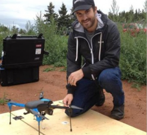
Coastal Monitoring Program – sUAS
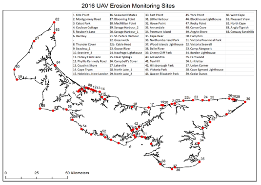 In 2015, the Climate Research Lab undertook research that would lay the ground work for a coastal change monitoring program using small Unmanned Aerial Systems more commonly known as UAVs or drones. This work involved validating the UAV data and developing techniques for detecting change. In 2016, an Island wide program was established with data being collected at 60+ study sites. This program is meant to capture annual variations in coastal change and provide insight into the impact of climate change on PEI’s coastal regions.
Prince Edward Island Climate Change Adaptation Recommendations Report
Climate change impacts will be increasingly felt across Prince Edward Island, and preparing for these impacts is vital in minimizing the risks posed to the Island economy and ecology. The UPEI Climate Lab is developing the Prince Edward Island Climate Change Adaptation Recommendations Report for the Government of Prince Edward Island. The recommendations selected for the final report aim to:
- Reduce vulnerability to current and projected climate change impacts;
- Increase resilience of the natural and built environment, the economy, etc.;
- Benefit from climate change opportunities, where possible; and
- Be relevant and practical.
With input from the public and sector representatives, specific recommendations will be provided for each of the identified sectors: Agriculture, Education, Energy, Fish & Aquaculture, Forestry & Biodiversity, Insurance, Public Health & Safety, Tourism, Transportation & Infrastructure, and Water.
Climate Stations
-
- Fanning Brook
-
- Foxley River
-
- Cape Egmont
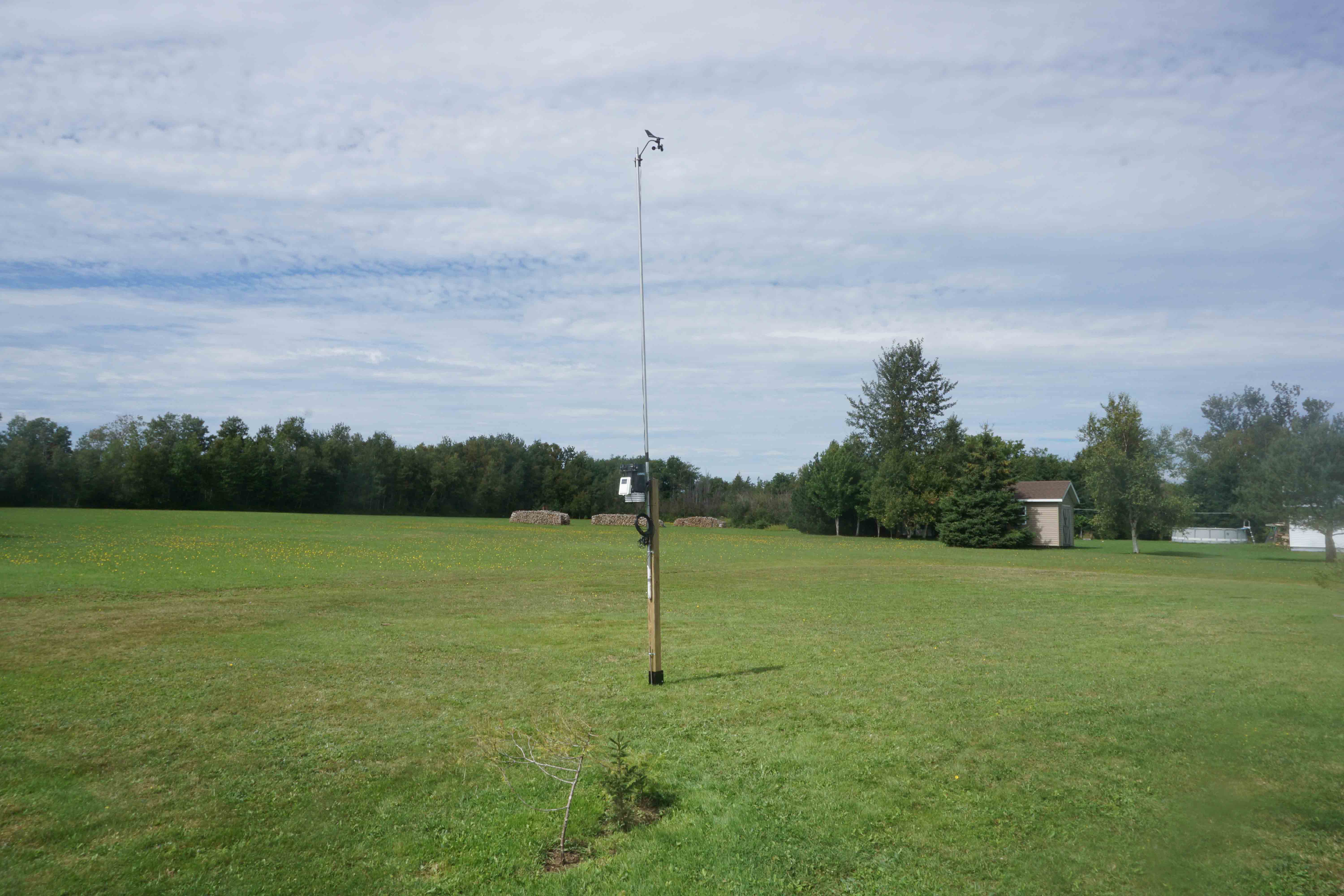
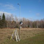
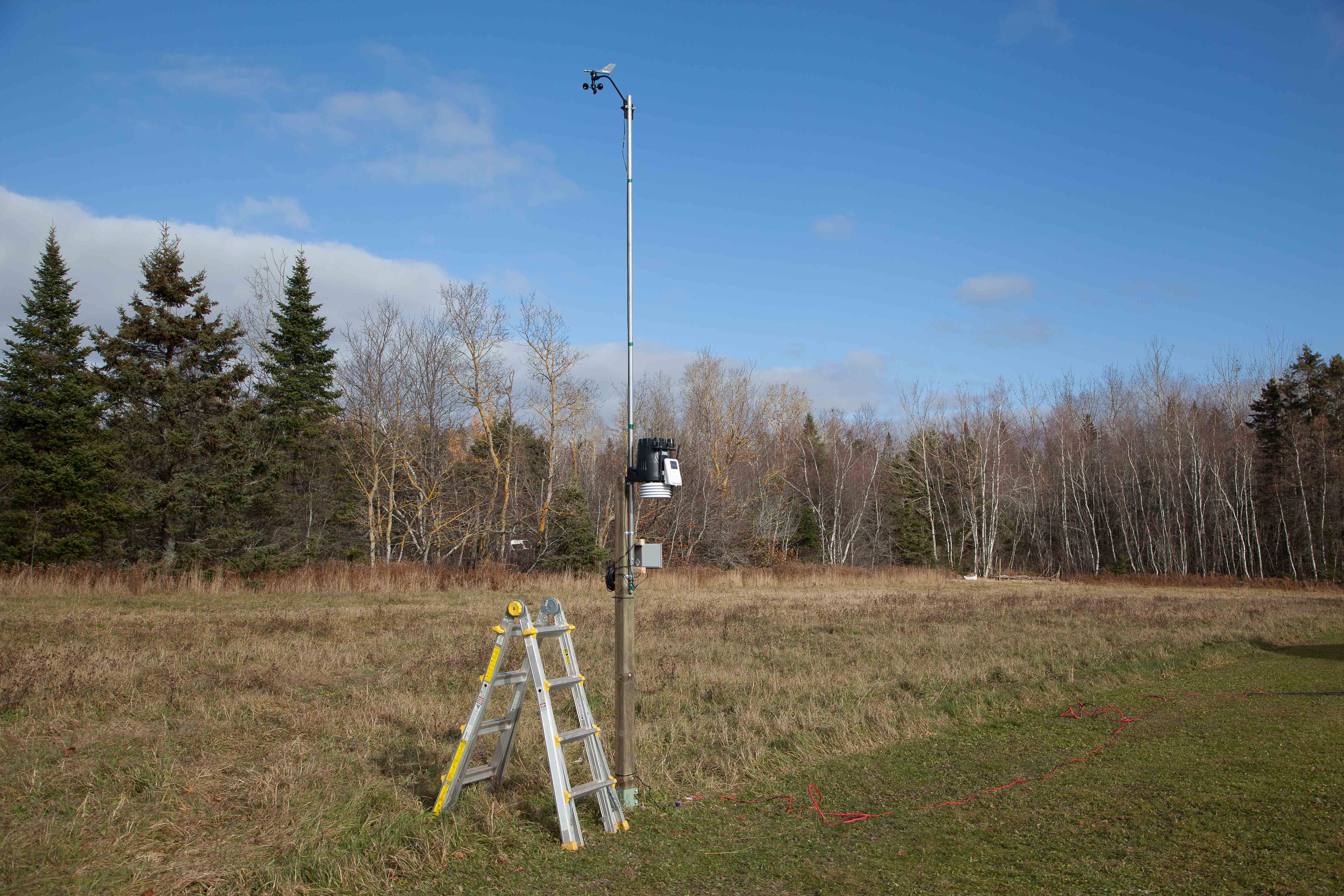
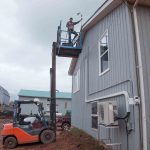
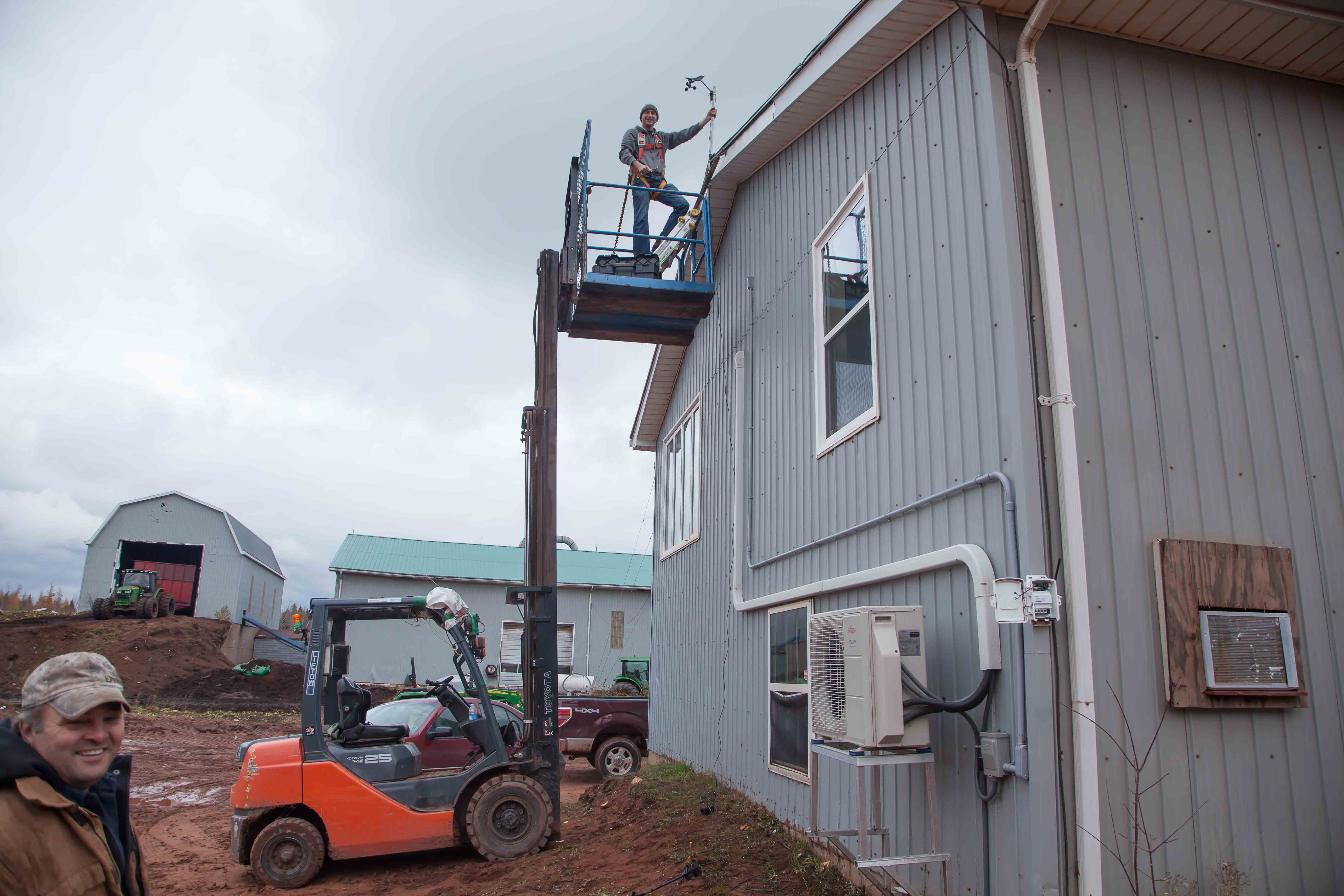
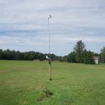
The UPEI Climate Lab is working with federal, provincial, university, commercial, indigenous and volunteer partners to bring together observations such as wind, temperature, precipitation and solar radiation from climate stations across the province. A reference climate data record is a key element in understanding PEI’s changing climate and helps in applied climatology needs for agriculture, forest and tourism operations, in reducing model uncertainties in climate variances, and in providing reference ground truth data to better evaluate climate model predictions.
The PEI Department of Community, Lands and Environment have funded the establishment of eight (8) Davis Vantage Pro 2 climate stations beginning in 2013. UPEI has installed twelve (12) climate stations in total at Winsloe South, Flat River, Orwell Cove, Foxley River, Dingwell’s Mills, Cardigan Head, Cape Egmont, Hampton, Brockton, Glen Valley, Fanning Brook and Tignish using the Davis weather stations. The PEI Department of Agriculture and Forestry also funded the installation of 4 Davis Vantage Vue climate stations at Arlington, St. Catherines, Alliston and East Point. Privately owned and operated climate stations at Elmwood, White Sands, Mill Cove, and Hope River have also been added to the UPEI monitoring network.
Using these stations and some federally operated stations, the UPEI Climate Lab has prepared monthly summaries of the climate data collected since September 2014, and has produced annual summaries for 2014, 2015 and 2016. Examining the map of sites below shows some obvious gaps in the network that should be filled along the west coast (West Cape, Roseville, Waterford, Alaska), north shore (Lennox Island, Greenwich), inland areas in all 3 counties and the east coast (Launching Place, Panmure Island, Murray Harbour).
Monthly Climate Summary – Jul 2018
Monthly Climate Summary – Jun 2018
Monthly Climate Summary – May 2018
Monthly Climate Summary – April 2018
Monthly Climate Summary – Mar 2018
Monthly Climate Summary – Feb 2018
Monthly Climate Summary – Jan 2018
Annual Climate Summary – 2017
Monthly Climate Summary – Dec 2017
Monthly Climate Summary – Nov 2017
Monthly Climate Summary – Oct 2017
Monthly Climate Summary – Sep 2017
Monthly Climate Summary – Aug 2017
Monthly Climate Summary – Jul 2017
Monthly Climate Summary – Jun 2017
Monthly Climate Summary – May 2017
Monthly Climate Summary – Apr 2017
Monthly Climate Summary – Mar 2017
Monthly Climate Summary – Feb 2017
Monthly Climate Summary – Jan 2017
Annual Climate Summary – 2016
Annual Climate Summary – 2015
Annual Climate Summary – 2014
Climate Diaries

The Climate Diary is a means for citizen scientists and to identify and record observations of naturally occurring plant and animal life cycle events over time on Prince Edward Island.
As the years roll on, this Climate Diary will provide a written record of changes in the environment as they occur year-to-year. These records will help scientists understand changes in the climate system and how these events are influenced by seasonal and interannual variations in climate. Eventually, these records will be a written testament to the effects of global climate change as temperatures warm through the decades, and precipitation patterns change.
The inspiration for this Climate Diary comes from Alexander Mackay, the superintendent of Nova Scotia schools from 1897 to 1924. Mackay enlisted the help of teachers and school children from across the province to collect observations of over 100 plants, animals and features of the physical environment, many of which are included in this Climate Diary.
From 1901 to 1923, Mackay mandated schools to teach natural history through his program of phenological observations, that is, the study of the synchronization of develop mental stages of plants and animals with the seasons. The timing of these cycles depends on climate factors such as temperature, moisture and day length. The phenological events of plants, which are easily observed such as the timing of buds opening or plants leafing out, can be used to characterize climate for a region for any given year.
Partners involved with the diaries include Nature P.E.I., Prince Edward Island Watershed Alliance, Kensington North Watersheds Alliance, and Southern Gulf of St-Lawrence Coalition on Sustainability. Financial supporters are Environment Canada and TD Bank Friends of the Environment Foundation.
To obtain a climate diary, please contact the Climate Lab at climate@upei.ca.
Climate Ocean Atmosphere Data Exchange (COADE)
The Climate Research Lab at the University of Prince Edward Island developed a valuable tool for researchers who require climate projections for anywhere on the planet. The lab has downloaded raw data from 40 global climate models and translated, analyzed, verified, and converted it into a usable dataset for researchers.
The models are the world’s most advanced science, and was part of the Fifth Assessment Report from the Intergovernmental Panel on Climate Change (IPCC). The Climate Ocean Atmosphere Data Exchange (COADE) is the only place in the world for queriable and mapable output from all 40 Global Climate Models used in IPCC AR5. “If researchers require projections that are monthly, seasonal, or annual over the next century, we can provide them” said Dr. Adam Fenech, director of the Climate Research Lab.
Researchers can get in touch with Dr. Fenech at climate@upei.ca.
Precision Agriculture
Precision agriculture is a farming management approach that uses data to identify and respond to inter and intra-field variability in crops. This approach was tested for potato crops in Prince Edward Island.
A multispectral camera was mounted to a small unmanned aerial system (sUAS) to monitor crop health in potatoes. Data collected with the multispectral camera was compared to in-season field health maps (July to September) with a yield map from harvest.
Climate Change’s Impact on Human Health
As the effects of climate change have been better understood, the potential danger of climate change affecting human health has become an area of concern. Climate change can affect health directly, such as trauma from storms or heat waves, or indirectly, such as the spread of disease or exacerbating existing conditions like asthma. With climate change and new emerging health concerns, these health outcomes will be changing rapidly. In addition, managing these health risks will require not only increased emphasis on public health, but also interdisciplinary collaboration, to yield positive adaptations. The aim of this project is to link one or more climate measurements with a specific health outcome using existing health and climate data in Atlantic Canada. Potential areas of interest include infectious disease (specifically rodent, water and vector-borne diseases), chronic non-infectious disease, mental health, and pre/post natal effects of climate. To this end, The Climate Research Laboratory at the University of Prince Edward Island will be hosting the first international symposium entitled “Impacts of Climate Change on Human Health”. The symposium will be held at PEI Greenwich National Park from October 5 to 7, 2017.
Assessing the Impacts of Coastal Adaptation Strategies
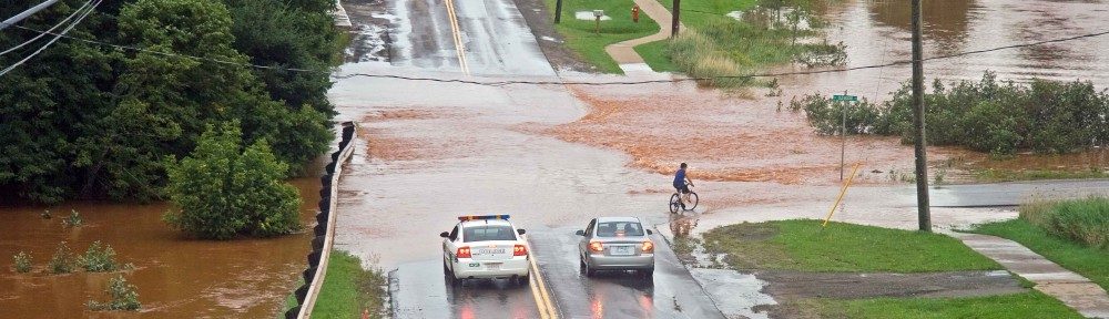
As coastal communities and property owners respond to the threat of coastal flooding and accelerated rates of erosion due to climate change, the impacts of coastal adaptation strategies on coastal ecosystems will require ongoing monitoring and evaluation. Shoreline stabilization structures can influence regional sediment transport processes, beach width and profile, and habitat connectivity between the marine, littoral and terrestrial zones. The first step to evaluate the effectiveness of these structures and their potential long term impacts on the coastline of Prince Edward Island will be to develop an inventory of existing shoreline structures and to assess the historic changes to the coastal geomorphology since their installation. The project will demonstrate the complex relationship between coastal environmental processes and human responses.
Using Cost-Benefit Analysis to Evaluate Climate Change Adaptation Options in Atlantic Canada
The Economics Working Group of Natural Resources Canada’s Adaptation Platform aims to enhance the understanding of the regional and sector-specific economic impacts of climate change and to generate knowledge of comparing relative costs and benefits of potential adaptation measures. As one of four regions to receive support from Natural Resources Canada to undertake a cost–benefit analysis (CBA) of climate change adaptation options, the Atlantic Climate Adaptation Solutions Association (ACASA) selected six coastal areas within the Atlantic Provinces for case study analysis. In each of the selected sites the risks to significant infrastructure and properties were assessed under the projected threat of coastal flooding and costal due to climate change, where applicable.
The sites were selected based on the project’s primary focus on the impacts of climate change on infrastructure and economic sectors including transportation, trade, ship-building, fisheries and tourism. For each case study, the CBA process involved the following steps: 1) identify impacts and costs associated with sea level rise and coastal flooding due to storm surge events and ongoing erosion, where applicable; 2) identify potential adaptation options that address the projected impacts and determine cost estimates of these options; and 3) calculate the net present value (NPV) and benefit to cost ratio (BCR) for each of the adaptation options proposed. The results provide a quantitative assessment on whether adaptation is warranted for a particular area from a financial standpoint, and an economic-based comparison of the proposed adaptation options. The main objectives of the CBA were to: 1) build on existing local assessments of climate change impacts and adaptation options by adding a layer of economic analysis; 2) support decision-makers in the selection of informed adaptation investments; and 3) provide an overall assessment of the usefulness of the CBA methodology in the context of climate change adaptation decision-making processes.
Coastal Community Adaptation Tool-kit
The Atlantic Climate Adaptation Solutions Association (ACASA) has partnered with Natural Resources Canada and leading researchers to develop the Coastal Community Adaptation Tool-kit to support communities in better understanding and preparing for the impacts of climate change. The kit includes:
- Interactive decision tool providing tailored adaptation solutions for communities. Users enter their community location and type, decision-making structure, existing land use, and known climate impacts and the online tool generates adaptation solutions tailored to the community.
- Guidance documents offering adaptation resources, including an introduction to adaptation, case studies of adaptation approaches in the Atlantic region, and best approaches for land use planning and engineering.
- Downloadable fact sheets describing engineering and land use planning options in a quick and accessible format.
- Community profile builder helping communities to identify and measure their capacity to adapt to climate change
The free tool-kit is available online at: http://atlanticadaptation.ca/CCAT.