Calculating Sea-level Rise and Storm Surge Flooding Scenarios

A Training Session and Q & A on Calculating Sea-level Rise and Storm Surge Flooding Scenarios

Presented by: Réal Daigle


Tuesday, August 14, 2018, 9 am to 4 pm
UPEI, Regis and Joan Duffy Research Centre (DRC)
550 University Avenue, Charlottetown
Cost: $100 per person (lunch is included)

Topics include:

  • Historical water level statistics
  • Science of sea-level rise
  • Methodologies and uncertainties in sea-level rise predictions
  • Regional sea-level rise estimates
  • Storm surge climatology and other flooding factors
  • Comparison of storm surge scenarios for PEI north and south shores
  • Exercise: Calculate storm surge rates

Space is limited. Please register at climate@upei.ca.

Visitors may park in any of the General Parking Lots at no cost and without a permit from mid-April to mid-September. These lots are labeled as General Parking Lots A, lower B, D, and E on the UPEI Campus Map. (DRC is Building 28 on the campus map)

Unmanned Aerial Vehicles (UAV) in Research Information Session 23-24 July 2018


Instructors:

Adam Fenech, University of Prince Edward Island

Andrew Clark – University of Calgary

Paul Nesbit – University of Calgary


Description:

  • How to purchase a UAV, the various models
  • How to plan drone flights, and operation options
  • Options and procedures for image processing
  • How to establish ground control points to increase the precision of data captured
  • Understanding scale considerations for answering research questions
  • The Department of Transport rules and regulations for operating UAVs
  • How to operate UAVs safely

Schedule:

Monday July 23

0830      Introduction to UAVs

0900      UAV for Coastal Monitoring on the Canadian Coast

1000      Geologic Mapping using UAV at Dinosaur Provincial Park, Alberta

1030      Break

1100      Spec’ing a UAV System

1200      Lunch

1300      Presentation by Roger Smith from Transport Canada on rules and regulations governing the application of drone technology to research activities, as well as the ins-and-outs of applying for a Special Flight Operating Certificate

1430      Break

1500      Flight Planning, Scale, Ground Control

1630      End of first day sessions

Tuesday July 24

0830      In Field Drone Flight Demonstration and Data Collection – Belle River, PE

1200      Lunch

1330      Structure from Motion

1400      Image Processing

1430      Break

1500      Data Visualization and Interpretation

1600      Final Questions and Discussion

1630      End of Final Day Session

Wednesday July 25

Rain date for Field Drone Flight Demonstration


Biographies of Instructors

Dr. Adam Fenech, University of Prince Edward Island – Dr. Fenech has been engaged in climate change research for thirty years starting with the 1988 Toronto Conference on the Changing Atmosphere which launched the climate change issue into the international policy agenda. Dr. Fenech was an inaugural member of the Intergovernmental Panel on Climate Change, a group that shared in the 2007 Nobel Peace Prize. Dr. Fenech has written policy speeches for Canadian Environment Ministers, represented Canada at international environmental meetings, and teaches regularly at universities across Canada and around the world. Presently, Dr. Fenech leads the UPEI Climate Research Lab where his graduate students use drone technology in their climate change research.

Andrew Clark, University of Calgary – Mr. Clark is a PhD student at the University of Calgary. Mr. Clark is the main programmer of the internationally-recognized sea-level rise visualization known as CLIVE (CoastaL Impacts Visualization Environment). CLIVE has won numerous awards including one from the prestigious Massachusetts Institute of Technology (MIT). Mr. Clark is the main pilot of the UPEI Climate Lab drones, and leads research in their application in the environmental sciences.

Paul Nesbit, University of Calgary – Mr. Nesbit is a PhD student at the University of Calgary. Mr. Nesbit’s research focuses on the application of UAVs and processing solutions. He holds a Masters of Science in Geographic Information Science and Geography  from California State University-Long Beach.


Our Incredible Shrinking Island

Storm waves crashing over the North Rustico breakwater on October 5, 2011 (Don Jardine)

Researchers from UPEI’s Climate Research Lab are travelling across Prince Edward Island over the next few months to speak with communities about sea-level rise.

Dr. Adam Fenech, director of the lab, and his team will make presentations to increase understanding and awareness about the impacts of sea-level rise, coastal erosion, and storm surges. They will also discuss tools for adaptation and coastal planning. Attendees will also have an opportunity to ask questions and to discuss what sea-level rise means for them.

The events are open to the public and will run for approximately two hours. Refreshments will be provided. There is no charge to attend.

  • Friday, February 16th – John J. Sark Memorial School, Lennox Island (4:00 – 6:00 PM)
  • Tuesday, February 20th – The Eagle Nest, North Rustico (6:30 – 8:30 PM)
  • Thursday, February 22nd – Fire Hall, Tyne Valley (6:30 – 8:30 PM)
  • Tuesday, March 6th – Eastern Kings Community Centre, Bothwell (1:30 – 3:00 PM)
  • Tuesday, July 3rd – Kings Playhouse, Georgetown (6:30 – 8:30 pm)
  • Wednesday, July 4th – Victoria Schoolhouse, Victoria (6:30 – 8:30 pm)
  • Monday, July 9th – Alberton Community Centre, Alberton (6:30 – 8:30 pm)
  • Tuesday, July 10th – Rossiter Park Community Building, Morell (6:30 – 8:30 pm)

Please RSVP by emailing climate@upei.ca or calling 902-894-2852.

These workshops are part of the national Educating Coastal Communities About Sea-level Rise (ECoAS) project, which is supported by financial contributions from Fisheries and Oceans Canada, the UPEI Climate Research Lab, the Mi’kmaq Confederacy of PEI, and the Ecology Action Centre. For more information about the project, please visit sealevelrise.ca.

The Winter Storm of January 4 and 5, 2018

Report by Don Jardine  (PDF version can be downloaded here)

A winter storm hit the Maritime Provinces on January 4th and 5th, 2018. Environment Canada forecasts for the storm predicted high winds from the east, south, southeast and southwest with gusts of over 100 km/h. Precipitation in the form of ice pellets, freezing rain, rain and snow were also forecast and a storm surge just below Stage 2 flooding levels for Charlottetown with a 60+ cm surge component for Summerside. Snowfall amounts were projected to be in the 15 to 25 cm rain with rain of up to 20 mm.

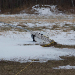
The UPEI Climate Research Lab maintains a network of climate stations across the province, which provides climate data for events such as this storm.  One of the UPEI Stations located in Glen Valley blew down on January 5th at 8:20 am when a wind gust recorded at 116 km/h occurred. A photo of the station after it was blown down is provided in Figure 1.


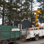
A tree was blown down on the Junction Road in Glen Valley at the same time and a photo is attached in Figure 2. Other trees and several large branches were blown down in several locations across the province. Power outages were also experienced in scattered areas across the province.


The Glen Valley wind gust was the maximum wind gust reported in the province during this storm except for reported gusts of 120 to 130 km/h on the Confederation Bridge during the evening of January 4th and early on the 5th. Other stations reporting high wind gusts were:

  • North Cape – 102 km/h
  • East  Point – 106 km/h
  • Charlottetown Airport – 95 km/h
  • Cape Egmont – 100 km/h
  • Borden/Carleton – 101.4 km/h at 7:30am on January 5th
  • Hampton – 96.5 km/h at 20:20 on January 4th

The precipitation from this storm did not reach the forecast amounts with the maximum amount of 23.2 mm of precipitation of all types being recorded at a CoCoRaHS site in Caledonia. Snowfall amounts were well below forecast amounts.

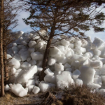
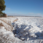
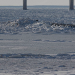
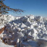
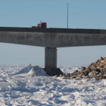
The combination of high winds, high tide and storm surge resulted in rafting of sea ice in some coastal areas with full exposure to the south and southwesterly winds. The Northumberland Strait coastal area between Victoria and West Point seemed to have been most impacted with ice chunks being compressed against the cliffs in areas such as Bell’s Point in Cape Traverse, Dawson Subdivision in Augustine Cove, the range light area in Victoria, Borden breakwater, Cape Egmont Wharf, Maximeville, West Point Lighthouse and other areas. Ice blocks were rafted to a height of over 8 to 9 metres in some areas causing ice to be deposited on the top of cliffs. According to a story on the CBC Prince Edward Island website, Philip Metcalfe of Cape Traverse stated, “It was a surprise to us because it happened so quickly”.  He had fallen asleep and when he woke the ice was over the cliff in front of his cottage. (CBC News, Jan. 5, 2018)

The peak water levels recorded on the Canadian Hydrographic Service tide gauge at Charlottetown during the storm were:

  • January 4, 2018 at 13:05- 2.85 m above chart datum or 1.17 m geodetic
  • January 5, 2018 at 00:30 – 3.56 m above chart datum or 1.88 m geodetic

The January 5th high water event is one of the highest water levels recorded on the Charlottetown tide gauge since 1911.


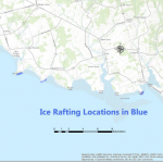
Ice rafting occurred at many locations during the storm and some are shown on figure 2. The areas where rafting occurred were all exposed to southeast winds at high tide and this occurred 00:30 on January 5th, 2018. The rafting areas are all exposed to deeper water zones near the shoreline line as areas with many sand bars would catch the ice blocks before they could reach the shoreline areas.

Ice rafting of the magnitude shown in the above photos is a relatively rare phenomenon on Prince Edward Island due to several conditions which must be met. These include a high tide, strong winds blowing on shore, low barometric storm pressure system, presence of ice, deep water near shoreline. The presence of ice in early January is unusual in recent years due to the warming of coastal waters due to climate change. Prior to this storm, there were 22 consecutive days between December 14th and January 4th, when the average daily temperature was below zero Celsius.

A documented episode of ice rafting occurred on February 19, 2004 when ice piled up at Maximeville against a cottage along the shoreline during the storm event known as White Juan. (Forbes, 2004)


P.E.I.’s Top 3 Weather Stories of 2017

Another year has gone by and it’s time to talk about Prince Edward Island’s top three weather stories of 2017. This past year continues to remind us of the important part weather plays in our everyday lives. Every year brings stories of weather no matter where you are, and Prince Edward Island is no different.

And while I am tempted to speak about the wild temperature swings of early February where temperatures changed an average of a degree Celsius per hour over a 36-hour period, or the poor visibility from the “redouts” some drivers experienced in June around Summerside when wind gusts of up to 70 km/h kicked up red Island soil, I will focus on my top three weather stories for 2017, and how they affected Prince Edward Island.

Number 3 – Severe Summer Thunderstorm

A severe summer thunder and lightning storm on July 21 knocked out power to 20,000 Maritime Electric customers during the height of the storm. Blamed on the higher than normal water temperatures in the Gulf of St. Lawrence – three to five degrees above normal for that time of year – the massive thunderstorm rolled over Prince Edward Island causing marble-sized hail stones to chip the paint from the siding of the house of Maureen Campbell-Hanley at Dingwells’ Mills, and uprooting a large tree in her backyard.  The Brackley Drive-In movie theatre was hit by lightning before 10 p.m. and had to close due to the damage to the $14,000 computer that manages the digital movies. “It was a little shocking,” said owner Bob Boyle. The torrential rainfall turned ponds, rivers and streams bright red from silt run-off, and led to a fish kill in Campbellton.

Number 2 – Beach Day Temperatures in Late October

Summer did not want to say goodbye in 2017 with new record high temperatures across PEI on October 24 and 25 fit for a day at the beach. A “conveyor belt of warm, southerly air” brought temperatures averaging 11.4 degrees Celsius above normal in Charlottetown and 12.1 degrees Celsius above normal in Summerside. Those October temperatures were similar to PEI summer temperatures – about 1.5 degrees below the average August temperature in Charlottetown and less than a degree below the Summerside August average. Even a white-sided dolphin was seen in October around the Hillsborough River in Mount Stewart due to the warm weather.

Number 1 – Dry Summer

The dry summer climate affected everything from potatoes to berries – straw, rasp and cran. Warmer and drier than normal weather in October led to a quicker potato harvest as it was easier to get them dug out of the ground, but the drier climate during the summer growing season led to a lower yield for many potato farmers on the Island. In 2017, PEI produced 23.66 million hundredweight (cwt.) of potatoes, down eight percent, or two million cwt., from 2016. Part of the lower yield can be blamed on the drier climate. Between June and September, Charlottetown normally receives 373.3 millimetres of rain, but in 2017, rainfall was down to 323.4 millimetres, with three of four months being below normal. Some crops like potatoes, in an ideal world, need about 25 millimetres of rainfall per week. An eight percent decline in potato production and growing demand in 2017 forced PEI french fry processing plants to buy potatoes from Alberta, a distance of about 4,575 kilometres, which is unusual. The last time this happened was back in 2001 when PEI had a severe drought, potatoes were shipped from as far as Saskatchewan.

The dry weather also affected the size of PEI berries. Normally 15 to 20 strawberries will fill a box for market, but in 2017 it took double that number requiring farmers to go over their fields twice as often to getting the quantity needed. Some PEI raspberry growers had yields in 2017 about a quarter of what it was last year due to the weather with its winter freeze-thaw cycles, the damp spring and the dry summer which all had a negative impact on the raspberry canes. Cranberry growers on PEI use several millions gallons of water to flood one field and allow the berries to float to the top and be harvested. The lack of rain was hard on cranberry growers in 2017 as even water reservoirs were low after the dry summer. Many growers were unable to harvest a crop in 2017 because there was not enough rain for the plants, or to float the berries during harvest.

Islanders love their weather. Islanders are defined by the weather – we live by it. We are at the whims of Nature and the weather it brings. It keeps us at home, keeps us from work, keeps our kids from school yet it brings communities together. While tragic at times, our weather brings out our great spirit of humanity, sense of community and commitment to always look out for each other. From North Cape to East Point, West Point to Murray Head – and all points in-between – weather shapes who we are. Happy Christmas to all.

. The PEI Weather Trivia Calendar 2018 is now available for purchase at Murphy’s pharmacies and the Bookmart book store. This year’s calendar offers 365 all new PEI weather stories for every day of the year; twelve beautiful full-colour PEI weather photographs; information about extreme rainfall events; the weather history of Greenwich, PEI; historical PEI weather stories about PEI automobile drivers switching to the right side of the road (1924), the first commercial radio station on PEI (1925), and  the Second World War (1939); and much, much more!


Questions? Contact Adam Fenech at afenech@upei.ca or (902) 620-5220
Weather Predictions for PEI Winter 2018

We are deeper into the winter than normal for my weather predictions for the season, yet everyone seemed to want to have a say this year. Accuweather, a private weather service, offered the first predictions in mid-October of a “warmer and drier” winter in eastern Canada due to the forecasted warmer than normal waters in the North Atlantic. The Weather Network, another private weather service, predicts a snowy, stormy winter season in the Atlantic provinces, while senior climatologist at Environment Canada David Phillips predicts a “milder than normal” winter in eastern Canada. Last winter was the seventh warmest in 70 years, so because climate is variable – it goes up-and-down year-to-year – is it time for a colder one?

Normally, a PEI winter (the months of December, January and February) averages -6 degrees Celsius and receives about 303 millimetres of precipitation, that’s rain or snow. Environment Canada uses climate models to forecast seasonal weather. Climate models are mathematical equations strung together that describe the chemistry and physics of the Earth’s climate system. These equations are calculated using the largest computers in the country, known as supercomputers. Environment Canada forecasts temperatures for the winter of 2017 (December, January, February) for PEI to be “above normal” with precipitation (snow and rain) “normal” for the Island. I must mention, however, that Environment Canada’s seasonal forecast models are accurate for Prince Edward Island only 40-50% of the time (which is not significantly better than chance, meaning flip a coin and you’ll have the same odds of getting the forecast correct). Environment Canada’s seasonal forecasts are accurate in Northern Quebec, the southern Yukon and Baffin Island, but here on PEI, they do not forecast as well.

We all know people who swear by almanacs when forecasting the seasonal weather, so I took a look at four of them. The 2018 Canadian Farmers Almanac forecasts the winter as “cold and snowy”; the 2018 Harrowsmith’s Canadian Almanac says the winter will be “drier and milder than normal”; and the 2018 Almanac for Farmers and City Folk calls for temperatures “above normal” and precipitation “below normal”. The 2018 Old Farmer’s Almanac, the one we are most familiar with as it has been forecasting seasonal weather since its first issue in 1792 (the time of George Washington’s presidency), uses a “secret formula” kept tucked away in a black tin box at the Almanac offices in Dublin, New Hampshire. The Old Farmer’s Almanac makes claims of 80% accuracy of their results, but studies of their forecasts show no better over the long-term than about 50%. The Old Farmer’s Almanac forecasts the PEI winter climate this year to be “milder” and “wetter” than normal.

My own research at the University of Prince Edward Island that examined over 140 years of weather observations in Charlottetown has shown that the climate has definitely gotten warmer and drier, especially over the past 10-15 years or so. And that’s where I put my forecast for this winter – to continue the trend and be “warmer and drier”.

Over the past five years, no one group has been “bang on” in predicting the winter climate – the best has been following the long-term climate trends of warmer and drier but this only worked three out of the five years, and really missed our savage winter of 2015. This inability to forecast seasons accurately is because the year-to-year climate is variable – it goes up and down. Climate is nature’s merry-go-round so it is often difficult to predict the coming season even with supercomputers, secret formulas or historical trends. To emphasize this point, we flipped coins to see what Lady Fortune’s forecast for the winter will be – the result being “colder and drier”. So there are many forecasts made but only one will be correct. Predictions are leaning towards a warmer and drier winter for 2018. We’ll have to wait a few months to see who is right, which truly emphasizes our inability to seasonally forecast well.


Predictions of PEI Winter 2017
Source Temperature

Warmer (+) Colder(-)

Average (=)

Precipitation

Wetter (+) Drier (-)

Average (=)

Environment Canada + =
Canadian Farmer’s Almanac +
Harrowsmith +
Almanac for Farmers and City Folk +
Old Farmer’s Almanac + +
Dr. Fenech +
Chance (Flip a Coin)


. The PEI Weather Trivia Calendar 2018 is now available for purchase at Murphy’s pharmacies and the Bookmart book store. This year’s calendar offers 365 all new PEI weather stories for every day of the year; twelve beautiful full-colour PEI weather photographs; information about extreme rainfall events; the weather history of Greenwich, PEI; historical PEI weather stories about PEI automobile drivers switching to the right side of the road (1924), the first commercial radio station on PEI (1925), and  the Second World War (1939); and much, much more!


Questions? Contact Adam Fenech at afenech@upei.ca or (902) 620-5220

PEI Climate Change Adaptation Recommendations Report – Now Available

The UPEI Climate Lab has completed its development of the Prince Edward Island Climate Change Adaptation Recommendations Report.  The report outlines anticipated climate change impacts for 10 different sectors – Agriculture, Education and Outreach, Energy, Fish and Aquaculture, Forestry and Biodiversity, Insurance, Properties and Infrastructure, Public Health and Safety, Tourism, and Water – and recommends a total of 97 adaptation actions to address them.  This was done with the help of input collected from online submissions, public meetings, and consultations with over 70 sectoral stakeholders.  The Government of Prince Edward Island will be using this Report in the development of its upcoming Climate Change Action Plan.

Despite the work being completed by the Provincial Government, effective adaptation requires coordinated efforts of individuals, businesses, sectors, research institutions, non-governmental organizations, and all levels of government.  Climate change is a shared problem that requires shared responsibility from everyone.  Planned adaptation takes time and the work to develop an informed, forward-looking, comprehensive adaptation strategy must begin immediately.  To achieve this, a clear vision of sustainability, the willingness to disrupt the status quo, a commitment to work together, and the urgency to act swiftly are needed from everyone.  It is insufficient to “prioritize” climate change adaptation; adapting to climate change must be considered a normal way of life.  Concerted effort from every Islander will be required for Prince Edward Island to successfully minimize the impacts that climate change will invariably bring.

Download the Main Report as PDF

Download the Summary Report as PDF


PEI Climate Change Adaptation Strategy: Public Consultation

The UPEI Climate Lab is developing the Prince Edward Island Climate Change Adaptation Recommendations Report for the Government of Prince Edward Island.  We are seeking public input to help us develop relevant, practical, and innovative recommendations for climate change adaptation.  Climate change adaptation refers to the ways in which we can take advantage of the opportunities arising from climate change, as well as reduce the negative impacts from climate change.

The recommendations included in this draft report were developed in four stages.  First, the public and sector stakeholders were consulted on their concerns regarding climate change and adaptation.  Second, adaptation approaches used in other jurisdictions regionally, nationally and internationally were reviewed to prepare a discussion document for each sector.  Third, roundtable discussions with stakeholders for each sector were held to review the relevance and practicality of the approaches in the discussion document for the Island and to suggest additional recommendations.  Last, the sectors’ input was incorporated in the discussion documents, which form the sector chapters of this draft report.

We are hosting a final round of public consultations next month.  They are open to everyone – individuals, businesses, organizations, etc.  You can provide feedback online until Friday October 20, 2017 and in person at one of the following public engagement sessions:  Continue reading

Breakfast seminars with the Honourable David MacDonald

Join the Honourable David MacDonald as he leads discussions on topics around the theme of Now That’s a Really Great Question – “Can Mother Earth and her peoples survive and thrive in the Anthropocene?”

These UPEI breakfast seminars will be held in Room 103 at 618 University Avenue, Charlottetown, Prince Edward Island every Tuesday morning from 8 to 10 AM during the weeks from July 4th to August 22nd, 2017. Free parking and registration.

Topics include: Continue reading

Public Input Invited on Prince Edward Island Climate Change Adaptation Strategy

The UPEI Climate Lab is developing the Prince Edward Island Climate Change Adaptation Recommendations Report for the Government of Prince Edward Island.  We are seeking public input to help us develop relevant, practical, and innovative recommendations for climate change adaptation.  Climate change adaptation refers to the ways in which we can take advantage of the opportunities arising from climate change, as well as reducing the negative impacts from climate change.  We created a Public Input Document to provide information about climate change adaptation and how climate change impacts will affect the Island. Continue reading